Day 1 – Redmond to Bruneau Dunes State Park, ID
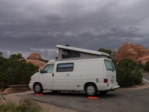
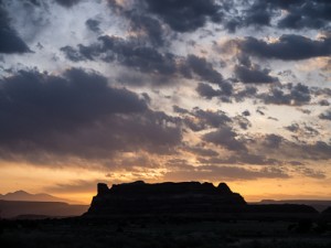
Today was the first travel day of the trip, a 560 mile drive from home to a park just outside of Mountain Home, Idaho. This would be a three state journey starting at 7:30 a.m. when we finished loading up the van and headed out for I-90 and Snoqualmie Pass. We made great time in Washington and hit The tri-cities area around 11:30 just in time to stop in Kennewick for Taco del Mar. We gassed up the van and headed into Oregon switching I-82 for I-84. Once out of Pendleton, where I hit up Starbucks for an iced latte, the seemingly never ending climb over the Blue Mountains began. By the time we got to Ontario hours later I was so glad to be leaving the climb and the ridiculous slow speed limits of Oregon. What kept us sane was listening to The English Major by Jim Harrison, a perfect road trip book. The Welcome to Idaho sign was quickly followed by a 75mph sign so we gassed up again and hit the road hard through Boise, into Mountain Home and finally to Bruneau Dunes State Park, our camp for the night.
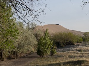
Bruneau Dunes turned out to be a great spot. Fairly isolated right off the Snake River with very few campers. There were huge sand dunes created by a major flood over 15000 years ago and, of course, we had to go climb them after sitting in the van all day. We took a hike, climbed the dunes and then returned to fix dinner.
Day 2 – Bruneau Dunes to Arches National Park
Another long driving day to get from Idaho to Arches. There was a lot of very boring and uncrowded driving down I-84 in Idaho and the top of I-15 in Utah then suddenly we had to deal with traffic. The SLC corridor from Ogden to Provo is about like Miami but with far worse drivers. We had semis that were driving by Braille with the rumble strips, people swerving while texting and a host of others just being stupid. We were frazzled and pulled out the Chipotle app to locate a place in Bountiful to stop for a burrito and regain our wits to hit the next half of the madness. I have to wonder what this is like at rush hour and by the time we turned off at Spanish Fork we were just glad to still be alive.
The drive over Hwy 6 was great, an amazing climb to Soldier Summit and then just driving across a vast high plateau in the Rockies. We stopped for caffeine in Price and continued on the beautiful stretch to I-70, a brief time on the interstate then off onto 191 to Arches.
The drive up into Arches was steep and incredible. We were sort of late so were just going to drive all the way up to the campground figuring we’d stop and hike the next few days. Somewhere around Balance Rock though the van made a horrible noise and began vibrating like crazy at the front end. We pulled over, I shut the van down and the vibration continued. Let it sit, start it up, still vibrating. We sat a while trying to decide what to do, we were half-way to camp and that was actually closer than Moab so we decided to continue on and hope for the best. We made it 2-3 miles before the vibration started again so we stopped, sat for 15 minutes and drove another few miles. By this time I’d figured out the problem was our cooling fan and really nothing else bad so we made it to camp and set up.
Frazzled, we just needed to walk and went up to the camp arch and then hiked down to Broken Arch before fixing dinner. My plan was to call around in the morning to deal with the van, until we had a plan we would just hike the park.
Day 3 – Devil’s Garden
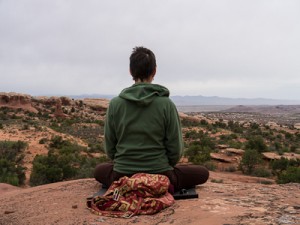
We awoke around 6 and had decided the night before to go meditate by Broken Arch in the morning so we grabbed yoga mats and zafus and started on the short trail to Broken Arch. There we sat in what had to be the most spectacular outdoor zendo around, overlooking the plateau all the way into Colorado. After sitting we did some yoga on the mats then hiked back to prepare breakfast.
I checked the car and in daylight it was pretty easy to see that the passenger side fan had blown itself apart. About half of the circle holding the blades was gone. I found the 10′ circle with cell range thanks to the camp host and called a local repair shop. I’d hear back later in the day.
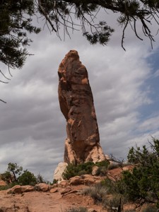
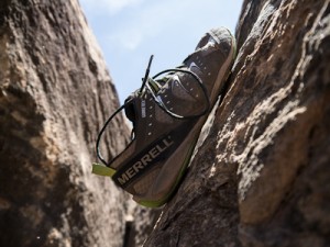
The hike plan for the day was to do all of Devil’s Garden, visiting 8 arches, the Dark Angel spire and returning via the primitive loop trail. We decided to go with Merrells instead of Luna’s which turned out to be a great decision though we did run into one guy with Luna’s on who was doing the loop in the reverse direction as us, his girlfriend had Merrells on. The Merrells ended up being perfect on the slick rock scrambling sections giving us great grip and great ground feel, I will lever wear real hiking boots again except for snow.
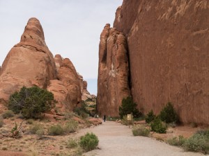
The trail starts off with am amazing trailhead through several large sandstone fins and is easy going up to the junction for Tunnel Arch and Pine Tree Arch which were our first two stops. Then we continued about a mile to Landscape Arch on easy trail before the fun began. After Landscape Arch there was some scrambling up a rock fin that was about as wide as a sidewalk but steep. This continued for several more very exposed sections of slick rock on top of fins until we got to t he cutoff for Partition Arch and Navajo Arch. Navajo Arch was amazing and we sat there in the shade and had a snack before going on. The next stretch to Black Arch overlook had some more very exposed sections before mellowing out some to Double O Arch. By the time we headed up the last of the trail to Dark Angel we were pretty much on our own and out of the crowds that we kept trying to avoid.
[jj-ngg-jquery-carousel html_id=”devilsgarden-jcarousel” gallery=”1″ height=”225″ width=”300″ visible=”2″ title=”Devils Garden Arches”]
After Dark Angel we had to decide on backtracking or doing the primitive loop which claimed to be hard to follow in places and involve some hard scrambling. The trail started out easy enough up to Private Arch then started to wind a maze-like path through Fin Canyon. About a quarter mile of this was pretty tricky and not for someone who hates walking on thin ledges with drop-offs. We ended up helping one guy through the hardest sections. The last 1.5 miles was pretty easy hiking again, connecting back up at Landscape Arch followed by one more mile back to the trailhead and a half mile to the campground. We did about 9.5-10 miles total on the hike.
We were pretty beat back at camp but I had to deal with the car still. They found the closest part in LA so we are having it overnighted to Moab tomorrow. The original trip plan changes only a bit, we’ll drive out of Arches on Thursday, stopping all the way out to hike various trails and do an extra hotel night. Friday the van will be fixed so we’ll still be off on Sunday to Canyonlands,
After a Mexican feast cooked up in the van we hiked (again?) to the Broken Arch area and sat again before walking back to camp for the night.
Day 4 – South Campground Loop
We started the day again sitting overlooking the plateau and then while Catherine did yoga I took off on a 3.5 mile run from camp to Landscape Arch and back in my Leadvilles getting a few strange looks. We met back up at the van for breakfast and then set out to hike the trails at the sound end of camp.
The trail to Sand Dune Arch started out in slots between some big fins before breaking out into an open green plain that led to the next set of fins. A short hike narrow hike through these fins led to a sand dune between two fins that climbed to where the arch was located. We didn’t stay too long due to crowds so back-tracked through the plain and took the trail to Broken Arch. We hung out at Broken Arch a while to have a snack and shoot some photos then took the trail to Tapestry Arch. This was a great arch to just sit under in the shade for a while before heading back to camp for a lunch break.
[jj-ngg-jquery-carousel html_id=”southloop-jcarousel” gallery=”2″ height=”225″ width=”300″ visible=”2″ title=”South Loop Arches”]
After lunch I tried to disable the bad fan so we could at least try driving to some other trailheads to hike in the afternoon but it was hopeless. Not wanting to make things worse we decided to just stick with the plan of hiking our way out of the park on Thursday, pulling the fan fuse if needed. After a bit of a rest we headed out again for Devils Garden and just hiked out to Double O and back without really dawdling. Coming back down the technical section just past Landscape Arch was a bit challenging, maybe more so than yesterday’s scramble but we did it and got in another 5+ miles for our afternoon hike, putting my run/hike total to about 14-15 miles for the day.
We returned to camp for a great dinner of mole pasole and tortillas before just putting the dogs up and chillin for the evening.
Day 5 – the rest of Arches
This morning we woke to the best sunrise of the trip so far and had an incredible meditation and yoga practice out on the rocks with the silence broken by birdsong and the occasional wind that swept through. After practice we had breakfast and broke down camp to head out of the park in 2-5 mile driving “pitches” interrupted with hikes.
First stop, the Fiery Furnace. We originally had hoped to hike this area but given the van troubles did not book a tour so we just did the short overlook trail and took some photos. So far the fan had not kicked on.
[jj-ngg-jquery-carousel html_id=”delicatearch-jcarousel” gallery=”3″ height=”225″ width=”300″ visible=”2″ title=”Wolfe Ranch to Delicate Arch”]
Next stop, Wolfe Ranch and the Delicate Arch trail. Just when we pulled into the parking lot the fan turned on and the vibration started, luckily the car could cool down while we hiked the 3 miles out and back. This was an amazing hike, one of the better we’ve been on anywhere. Starting at the old Wolfe Ranch cabins, crossing Salt Creek and wandering through desert scrub while seeing the huge slick rock dome we would soon be climbing. The climb up the rock was easy for a good half mile then turned to a narrow ledge winding around a rock formation with a Mars-like landscape all around. On the ledge you round a turn and there is Delicate Arch standing alone in a huge rock amphitheater, simply amazing. We hung out a while, took a few photos, then headed back down the trail.
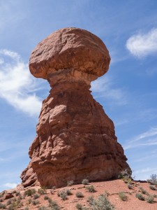
Next stop, Balance Rock where we circumnavigated the rock and enjoyed lunch on the shady side. So far so good.
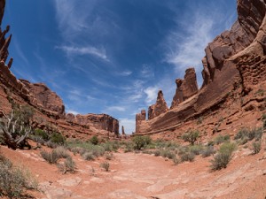
Onward to Park Avenue where the van began vibrating just as we pulled into the parking space. We took the 1 mile walk down the Courthouse Wash through the huge rocks of Park Avenue and Courthouse Towers which did almost feel like walking between natural skyscrapers. At the Organ and Three Gossips we turned back and retraced our path back to the van.
Last stop was the Visitors Center where we soaked up some AC and let the motor cool before the last push to Moab. We ended up getting to do most of the hikes we had wanted to do in the park except the short ones in the Windows section so even with car trouble the trip to Arches was a huge success. Total mileage for the day was only about 7 miles but we needed a light day after the previous two days.
We made it into Moab just in time and pulled into our hotel just as the van heated up again. After a much needed shower we roamed down the street to Miguel’s Baja Grill where a margarita and giant burrito, dubbed the M.O.A.B. (Mother Of All Burritos), waited. Luckily our waiter had on a pair of Merrell Trail Gloves and turned out to be a trail runner so I got the scoop on a few potential runs from in town.
Day 6 – Moab
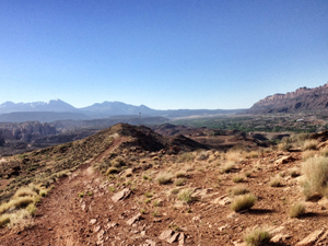
We slept great in a real bed last night and awoke to an amazing sunrise in downtown Moab. I wandered down the street to the Moab Coffee Roasters for a latte and then headed back to get ready to take the van in to Arches Repair. In the cool air the van made it the few miles down the road without trouble. I handed over the keys, grabbed my handheld, put on my Lunas, and took off for a run. I crossed the highway and wound my way by road and dirt trails to the Mill Creek trail which I followed to the end. Then I ran up Mill Creek Road until it turned into Sand Flat Road and began a steep climb up to the Slickrock Mountain Bike trail system. I stayed on the shoulder as much as possible and when I cam to the Hell’s Revenge ORV trail I ran it a bit before finding an opening to a hike/bike trail that followed the ridge overlooking Moab. I followed that until I had done 3 miles then headed back down and the way I came but took the Mill Creek Trail back to our hotel. Catherine had done a run too but stuck to the trail system in town.
Meeting up at the hotel we had breakfast and then Catherine did yoga while I went to grab another latte and check out the Moab Adventure Center. I also found the other dirt trails off the paved system to run tomorrow or Sunday. Catherine was doing yoga at the pool so I jumped in the hot tub to massage the legs. Catherine told me to go get a massage so I got on Yelp!, found Spa Moab and their foot/leg treatment and was walking down there in a few minutes. It was great to get my dry and cracking feet hydrated and massaged while also getting a hot stone leg massage. I felt great afterwards and the repair shop called and the van was done.
After lunch we walked to get the van and stopped at the market to restock our supplies. I then took Catherine back to the spa to see the pastels there and we hit up a few other galleries before relaxing a bit prior to dinner. Also noting the very demonic theme of the trip thus far (Devils Garden, Dark Angel, Hell’s Revenge) I had to get a Pagan Mountaineering t-shirt. It is good to have the van back in working order, we’ll give it a test run up to Island in the Sky tomorrow before committing to the Needles on Sunday.
Day 7 – Canyonlands, Island in the Sky
Today we got up and did a run on the trails in town, heading down the paved Mill Creek Trail until it turned to dirt and then continuing on in the Anonymous Park BMX trails for an easy 2.5 mile run. After getting a latte we had breakfast and packed up a lunch and gear for a day trip to the north part of Canyonlands – Island in the Sky.
[jj-ngg-jquery-carousel html_id=”islandinsky-jcarousel” gallery=”4″ height=”225″ width=”300″ visible=”2″ title=”Neck Spring Loop”]
We opted to avoid the long drive through the park which led mostly to short overlook hikes and instead did the 6 mile Neck Spring Loop Trail. The book described this as “a fine day hike, surveying much of the varied scenery and environments found on and near the Island in the Sky Mesa.”. That pretty much sums it up. The hike had sweeping canyon views, walks across old cattle lands, a descent into several canyon arms with small springs and creeks, an ascent nearly straight up a sandstone dome and walks across slickrock at the rim of the canyon. The six miles took three hours to cover and most of it was pretty easy aside from the steep ascent about halfway in which required quite a bit of scrambling up the rock dome. After that was a very casual walk along the rim over slickrock alternating with sand trails. A great way to spend the late morning and early afternoon.
We returned to Moab for our last night of luxury and hung out at the pool until dinner time. We headed back to Miguel’s for a Cinco do Mayo Mexican feast, a great way to end the day. Tomorrow it is back on the road to the Needles district of Canyonlands for a few days of hiking before starting the drive back home.
Day 8 – Canyonlands, the Needles
This morning we decided to have breakfast in Moab and then pack up the van to head south for Canyonlands. Since I got a lot of the gear organized last night we were pretty efficient and left town by 8:00 heading down 191. The drive went pretty well though the 34 miles from 191 to the park took a while. We even ran into two cowboys and a small herd of cattle they were moving, one calf bottled across the road but was quickly moved back into the herd.
We stopped at the Needles Outpost quickly to check it out, our destination if the park’s small campground was full. We ended up lucking out and got a spot at the Squaw Flat campground so there won’t even be a need to move the van for a few days. We got camp setup, made lunches, packed our butt packs and headed out for Chesler Park from the Loop B trailhead, a nearly 10 mile out and back hike. We opted for the 1.2 mile route to the junction instead of the 0.3 mile route to Loop A trailhead and 0.5 miles to the trail junction. This quickly turned into an adventurous route as we climbed a cable up very steep red rock to the top of a ridge which we then traversed for half a mile, going up and down the rounded tops of spires with exposure on both sides.
[jj-ngg-jquery-carousel html_id=”delicatearch-jcarousel” gallery=”5″ height=”225″ width=”300″ visible=”2″ title=”Chesler Park Overview”]
Once we started down the trail to Chesler Park it was a mix of scrambling down into one canyon floor, walking on easy sand trails a bit then climbing steeply up the next ridge and down into the next canyon. Some spots required real scrambling with hands and feet. One spot led through a narrow slot canyon just wide enough to pass. Pretty amazing scenery in every direction at all times and a terrain so varied that the hike never got dull. We stopped a t the trail junction of the Chesler Park loop, had lunch, hydrated up and rested a bit before heading back.
On the way back we opted to avoid the high ridge and took the trail to Loop A and the short up and over the “mushroom” top rocks to Loop B and the van. We stopped at the top to do our afternoon meditation before dropping down to camp. Exhausted and thirsty we drank up water and coconut water and had some chocolate to get enough energy to cook dinner. A pot of mole pasole was soon hot and we settled down for dinner. Tomorrow another long multi-canyons hike awaits, our last full day of hiking for the trip.
Day 9 – Canyonlands, Squaw Canyon to Big Spring Canyon Loop
Today was our last full day of hiking so we decided to do the 7.5 mile loop trough Squaw and Big Spring canyons, plus the 1.5 miles to get to and from the trailhead making for a 9 mile hike again. We got up, had breakfast, made lunch and hit the trail early to avoid the late day heat.
[jj-ngg-jquery-carousel html_id=”delicatearch-jcarousel” gallery=”6″ height=”225″ width=”300″ visible=”2″ title=”Squaw Canyon to Big Spring Canyon”]
The trail down Squaw Canyon was pretty mellow, a lot of walking through the flat at first, over one rock band and then on sandy trails that followed Squaw Creek as the canyon grew ever narrower. At around 3.7 miles we began a climb up to the end of the canyon and we could see the path that lay in store for us, straight up a slickrock corner to the top of the canyon. We stopped at the 3.9 mile trail sign and got ready for the ascent. The friction pitch up the corner was a bit scary looking and very exposed but the footing was great with the Merrells and we both made it to the top without any trouble. We stayed on the divide for a snack and some photos before heading down an equally steep section into Big Spring Canyon. There were a few short, steep sections and required crab walking down the rock. Once down to the floor it was a pretty mellow hike back up the canyon following a bit of a creek along the way. We finally got back into the “mushroom” rock land near the campgrounds and climbed up and over the last set of rocks to the trailhead. The hike itself took 4 hours plus another 45 minutes or so to get from our camp to and from the trailhead.
After rehydrating, snacking and resting a bit I put on my running shorts, laced on my Leadvilles and headed out for a 3 mile run. I took the road to the Loop A trailhead then went down the Squak Canyon trail a mile before turning back and heading back to Loop B via the slickrock trail. It felt great to be running on the rock and sandy trail in the Luna’s. Afterwards I hung the solar shower from a tree and showered and washed my hair, that felt great. Catherine did some yoga at camp after which we sat and then we prepared dinner which was leftovers from last nights pasole and rice.
Day 10 – Starting back
Today we awoke at sunrise, packed up the van and did our last hike in Canyonlands before breakfast. We headed out of the campground and drove up the scenic drive road to the Slickrock trail which was a short 3 mile loop with some great viewpoints, especially in the early morning light. After the hike we drove to the picnic area where we had a picnic breakfast. We had a raven as a breakfast guess and we thought he was going to come into the van to get to food.
[jj-ngg-jquery-carousel html_id=”devilsgarden-jcarousel” gallery=”7″ height=”225″ width=”300″ visible=”2″ title=”Slickrock Loop”]
After breakfast we hit the road, planning on spending the night in Park City and taking 191 North to US 40 to get there, a reported 5 1/2 hour drive. Well, we hit road construction on 191 going from Canyonlands to Moab so the drive that took us about 75 minutes going south took over 2 hours going north. We made good time from Moab to Price and then turned onto 191N outside of Helper. This road quickly turned into a twisty and steep road that seemed to just get twistier and steeper until finally the van was barely moving as we hit the tree line but were still climbing. I was getting a bit nervous but we finally hit the summit at 9133′ and began the long descent into Duschene. Hwy 40 was much more enjoyable and at least we could go 65-75 until the final climb to Daniel’s Summit at 8200′. Then a nice downhill to Herbert City followed by more road construction to Park City but we made it after 8 hours. We got checked in at the Marriott on old Main, showered and headed out for a burrito and a walk to the end of the historic district and back. It was a long day but only 885 miles to go to get home.
Day 11 – Utah to Oregon
We decided to get in a workout, shower and breakfast in Park City before hitting the road today for a fairly long haul through the rest of Utah, all of Idaho and a bit of Oregon. While Catherine hit the fitness center I asked at the desk about any trails close by. They told me about the Poison Creek Trail, a Rails to Trails project right out the door. I took off and found it to be paved. I ran down it a half mile eyeing the ski slopes to the west and ran over to Park City Resort and started up the mountain following the First Time beginners run, then the 3 Kings intermediate run until I got to the top of the lift and where it got really steep. At 7500′ or so I was out of breath already so turned down, ran down to connect to Easier Way and followed it back to the resort and then back to the paved bike trail. A pretty good 4 mile workout. I went and got a latte then we had breakfast in the room with our camp food before packing up and heading out of town.
We followed 40 to I-80 east then connected to I-84 to totally bypass the SLC craziness. It worked pretty well dumping us out in Ogden above most of the bad traffic. By lunch we had crossed over into Idaho and made sandwiches at some rest stop in the middle of nowhere. We drove another 5 hours into Oregon and finally to Farewell Bend State Park on the Snake River. This is a beautiful park but maybe the windiest place I’ve ever camped, seems even worse than the Deschutes if that is possible. We set up camp and made dinner before going for a walk down to the river. There we watched the sun set, watched swallows enjoying the evening hatch, saw raptors flying over the river and saw spring chinook heading upstream throwing themselves out of the river. Pretty amazing. And then the wind really started to blow, by the time we got into the van the entire thing was shaking from the gusts. It is going to be rough seas in the top bunk tonight.
Day 12 – Back Home
We got up and hit the road right after breakfast, the wind was still blowing. The drive home was pretty much just a long drive across the rest of Oregon and through Washington to home with a stop in Richland for lunch. Oddly, the Taco del Mar we ate at on the way down was out of business on the way back so we found another Mexican place close by. It was nice to be home but sort of sad for the trip to end, we vowed to make the next trip much longer.
Gear
We did this trip very minimalist gear-wise. For real hikes we wore Merrell barefoot gloves of one form or another. These things stuck like glue to the slickrock and had great ground feel to them. To me they felt about like climbing shoes on the sandstone slabs we were scrambling on, the friction was fantastic and the thin sole and narrow profile allowed you to feel every small foothold and divot in the rock. I have no idea how people where traditional hiking boots on some of this. Catherine used Keen socks while I stuck with Injini socks, mostly the lightweight ones. For driving, camp, light walks, and running it was Luna Leadville sandals which weigh nothing, pack flat and also have great traction on the rock.
We only used fanny packs that pretty much held a bagel sandwich, some trail mix and two water bottles each day. I used a Nathan electrolyte tab in one bottle and water in the other while Catherine used her own mix of coconut water and Emergen-C diluted with water. I also carried my camera, a Lumix G3, with a 14-45 lens attached most of the time and an 8 Fisheye lens in my bag. I only used the 45-200 or 100-300 at camp, not wanting to carry the weight and not really needing it for most of the views on our hikes.


