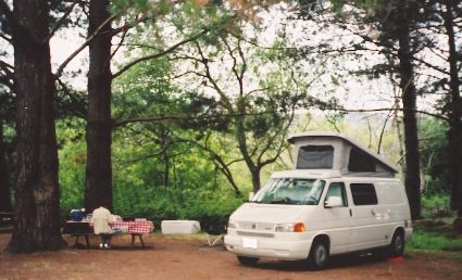
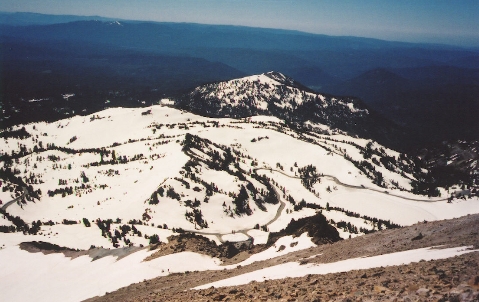
We got up early with plans to drive through the park on Hwy 89 early and then head out to Pt. Reyes. We climbed to the road summit at 8200' and got out to take some pictures of Lassen Peak which seemed so close just a few thousand feet above:
In the parking lot we met an obviously crazed telemarker who was gearing up and getting ready to climb the mountain to ski back down. He said we could easily reach the summit, even in tennis shoes! It was still early, about 8:00 a.m. and we decided to go for it. We put on our hiking boots, grabbed water and a bit of food and took off up the "trail".
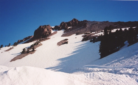
 The
first 700' or so of climbing was up a snow field that got progressively steeper
and progressively icier, at one point we were on all fours going up the ice.
We were told the path got easier after that and it did though we had multiple
snow fields to cross and found many places where the trail was lost.
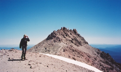
Finally we gained the ridge and began the series of switchbacks up it to the
final summit ridge. At the false summit you could see Mt.
Shasta clearly off in the distance, the only thing higher than we were about to
get.
The
first 700' or so of climbing was up a snow field that got progressively steeper
and progressively icier, at one point we were on all fours going up the ice.
We were told the path got easier after that and it did though we had multiple
snow fields to cross and found many places where the trail was lost.
Finally we gained the ridge and began the series of switchbacks up it to the
final summit ridge. At the false summit you could see Mt.
Shasta clearly off in the distance, the only thing higher than we were about to
get.
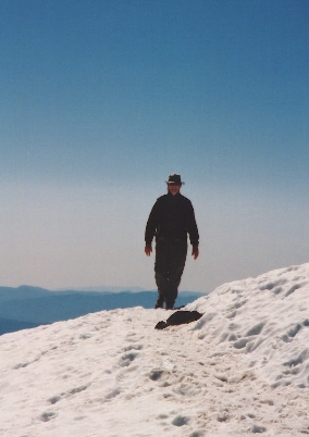
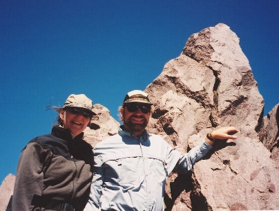
 Leaving the snow on the small plateau we headed to the rocky summit. We
had a few false attempts at getting to the top, coming out on steep faces or
hard rock scrambling but finally kept going up and managed to land on the summit
of Mt. Lassen at 10,457' in just under 2 hours. On the summit at last:
Leaving the snow on the small plateau we headed to the rocky summit. We
had a few false attempts at getting to the top, coming out on steep faces or
hard rock scrambling but finally kept going up and managed to land on the summit
of Mt. Lassen at 10,457' in just under 2 hours. On the summit at last:
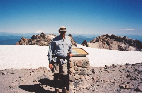
 Our
telemark friend and a boarder were there and we watched them get ready to go as
we munched cookies and re-hydrated before heading back down the trail.
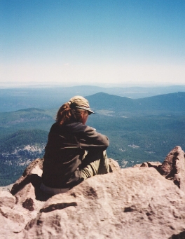
Here is where we came from and how far we have to go to get back. This is
just past the summit on the main ridge again.
Our
telemark friend and a boarder were there and we watched them get ready to go as
we munched cookies and re-hydrated before heading back down the trail.
Here is where we came from and how far we have to go to get back. This is
just past the summit on the main ridge again.
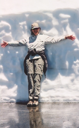
Back at the parking lot, Catherine decided that she needed to cool off a bit:
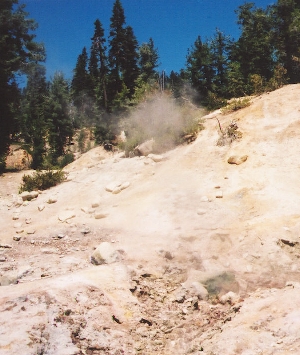 After
getting back on the road we explored the rest of Lassen a bit, stopping at the
geysers and mud-pots to see that the mountain we had just climbed was still
pretty active. Here is one of the geysers sending out steam
and a pretty strong sulpher smell.
After
getting back on the road we explored the rest of Lassen a bit, stopping at the
geysers and mud-pots to see that the mountain we had just climbed was still
pretty active. Here is one of the geysers sending out steam
and a pretty strong sulpher smell.
Leaving the park, we took Hwy 36 east into Red Bluff, got on I-5 again and began the trek south. We bypassed Sacramento on I-505 and connected to I-80 heading east again. We were happy to hit Hwy 12 around Napa and get out of the traffic on I-80, from there on it was two lane roads into Petaluma where we ate pizza and finally into Olema where we set up base-camp for the next few days at Pt. Reyes.