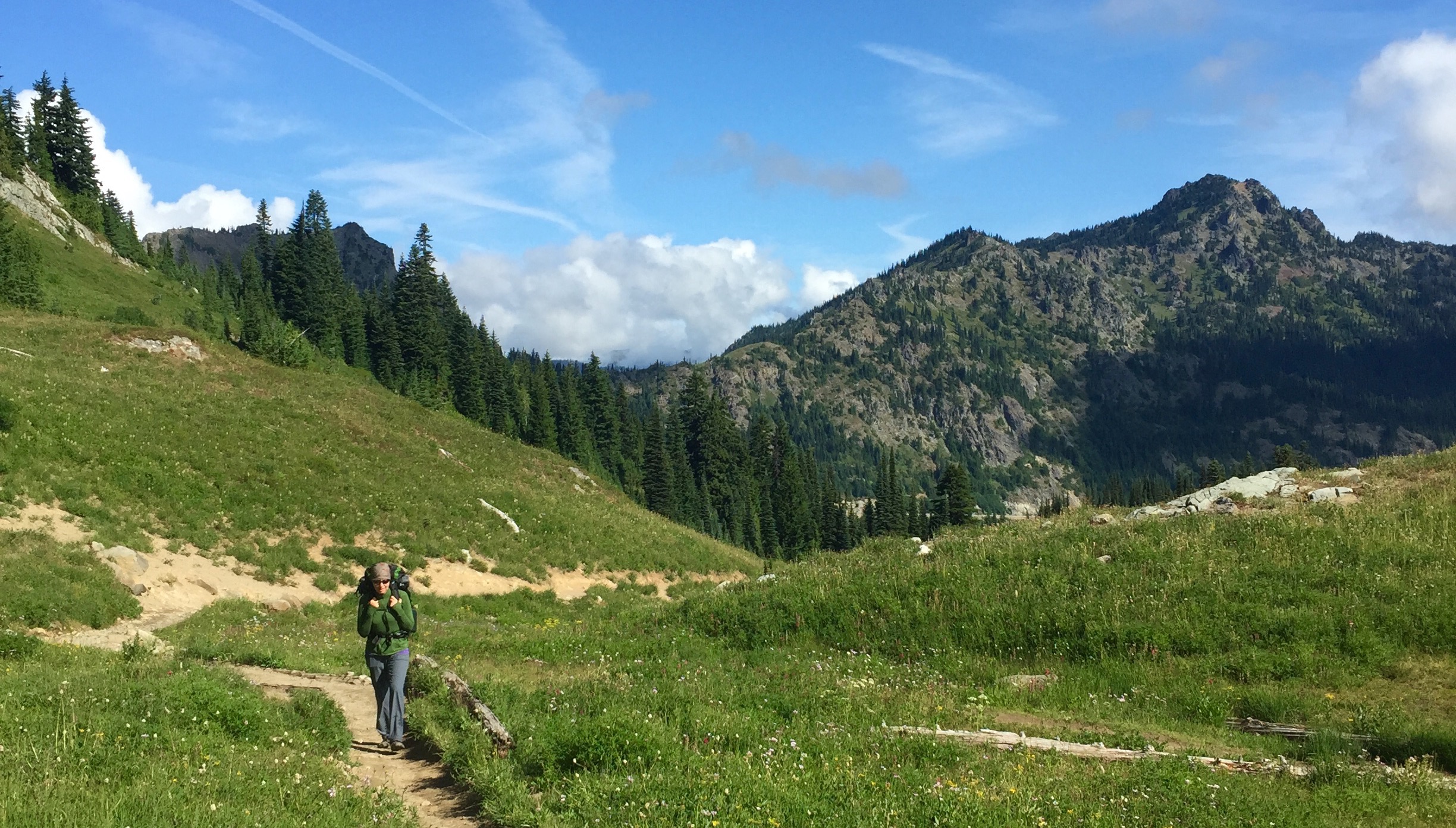
After our first two successful overnight trips to Mirror Lake and Rachel Lake/Rampart Ridge we decided to take on a bigger challenge and do a 3-day trip. We opted to do the 2015 Ultrapedestrian Wilderness Challenge Chinook Pass loop – a 32 mile long loop that starts at Chinook Pass on Hwy 410, goes south on the Pacific Crest Trail, drops into Mt. Rainier National Park on the Laughingwater Creek Trail then takes the Eastside Trail north through the park back to Chinook Pass. Most people are running this in 8-12 hours but we decided to take the slow approach and do it as an ultralight backpack trip in 3 days and adding in a few extra miles in order to camp and see a few more sights.
Day 1 – Chinook Pass to Three Lakes Camp (12.77 miles)
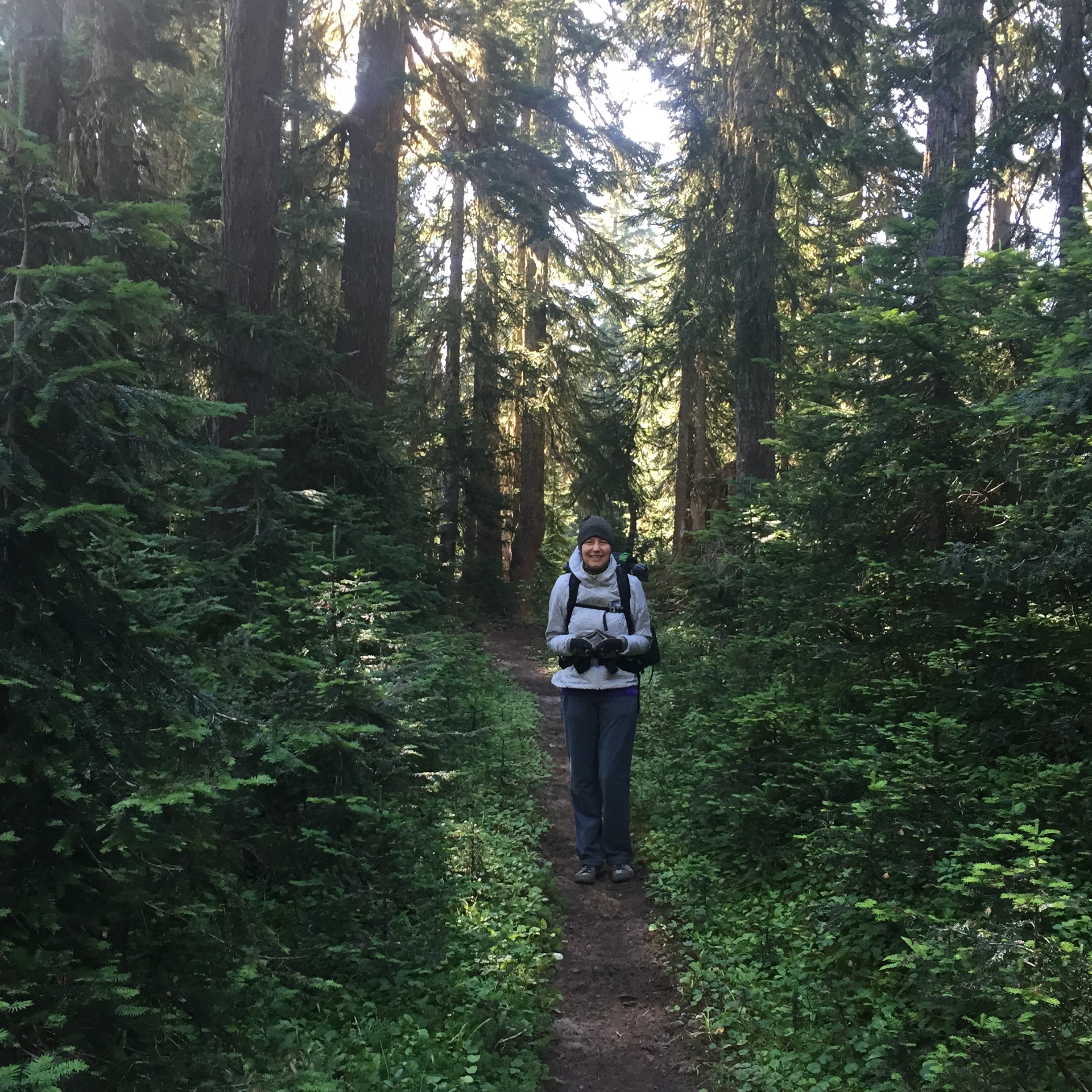
Heading down the PCT
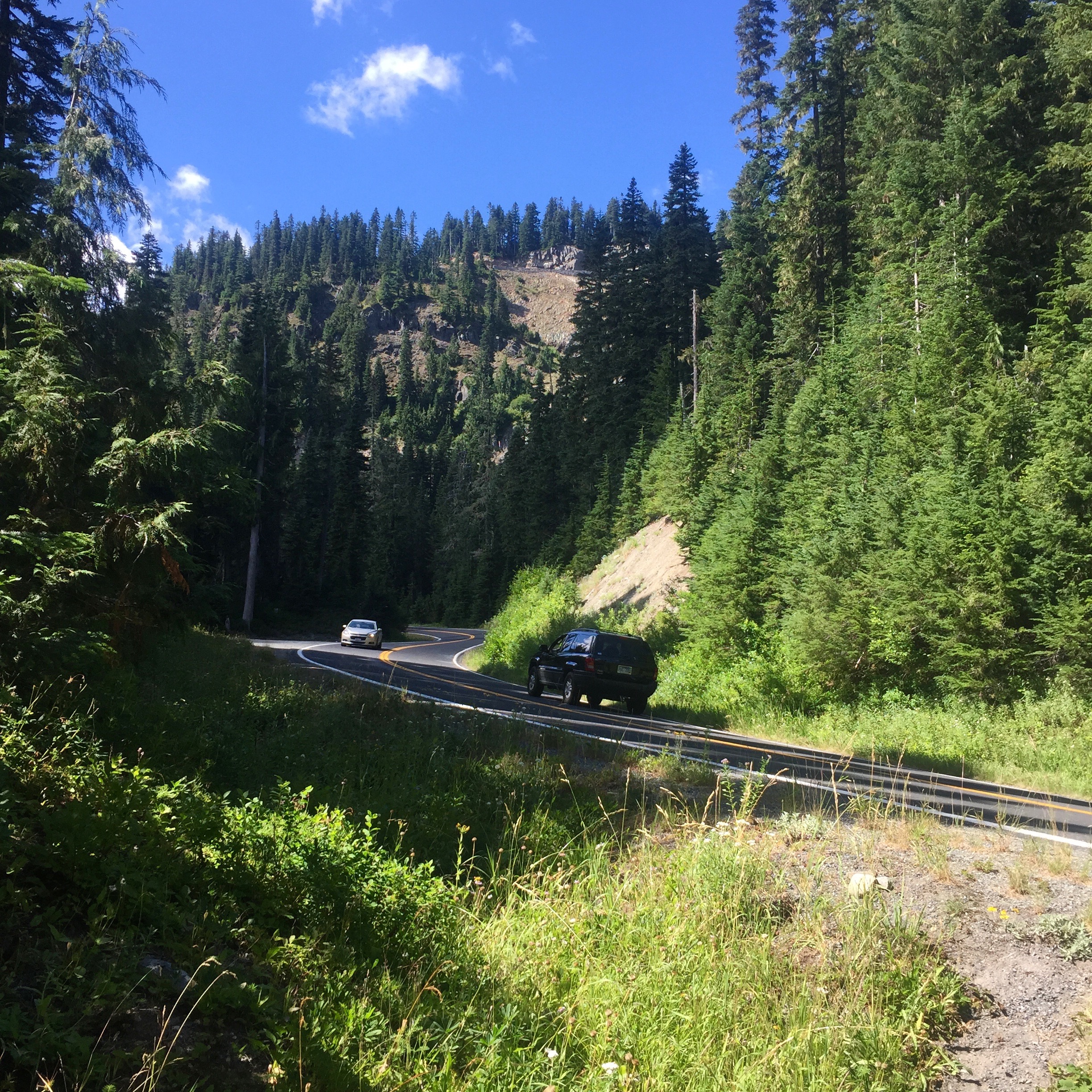
We seemed to pick the perfect 3-day window weather wise where the heat had finally mellowed out and we had a forecast for temps in the mid 60’s at high altitude and upper 60’s at Ohanapecosh with no rain in the forecast. On Tuesday, the 14th we departed home after breakfast and did the 90 minute drive to Chinook Pass. We changed shoes, got on our packs and hit the trail at 9:00 a.m. under blue skies.
 Heading south on the PCT we soon entered the William O. Douglass Wilderness and were greeted by a chipmunk on the tree next to the sign. We passed a few snow melt tarns before finally coming up on a view of Dewey Lake below us. We began the 700′ descent into the lake where we figured we’d stop and have a snack. We arrived at the lake about 3 miles into the hike and found a good spot to rest and take in the scenery.
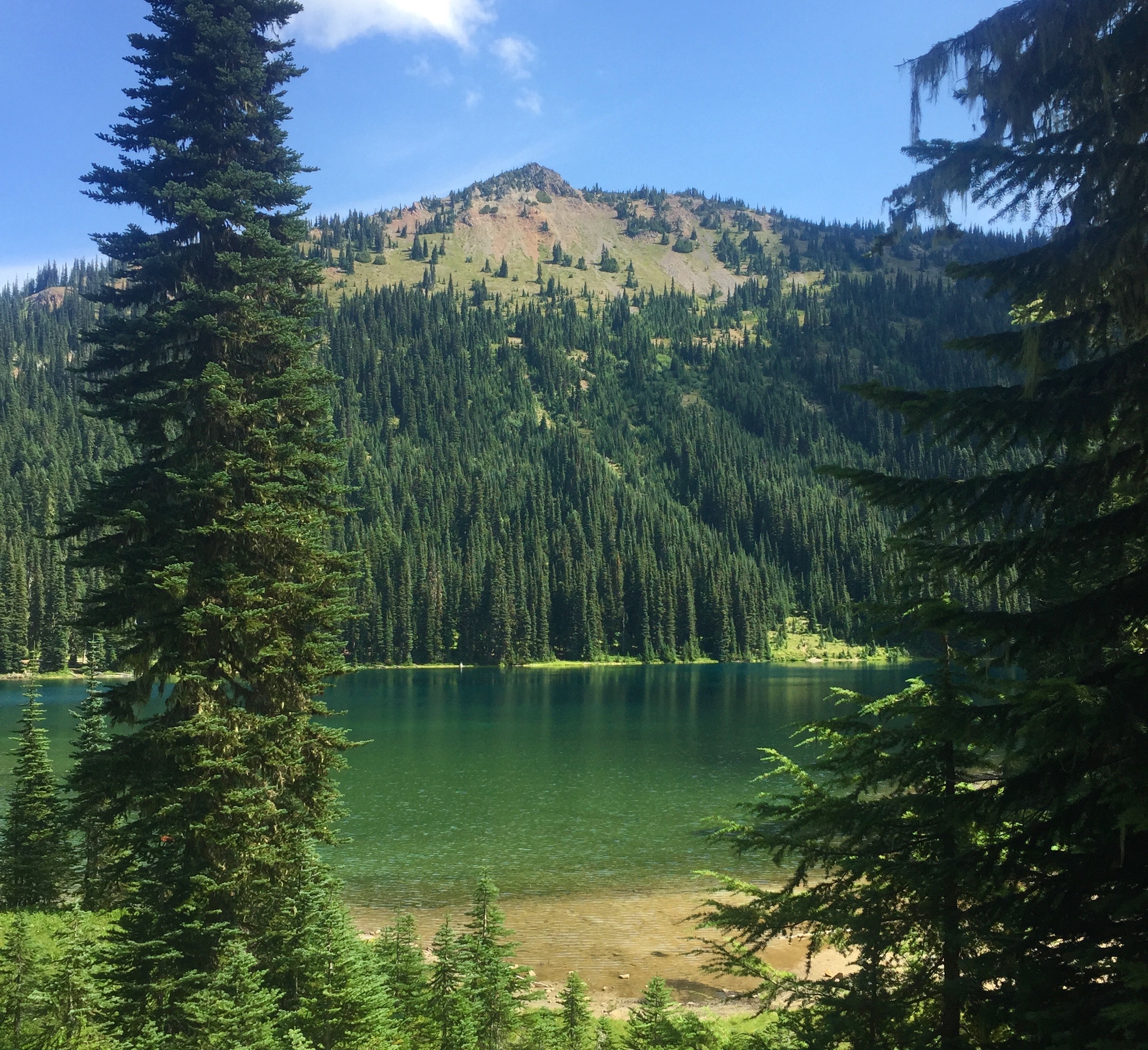
Dewey Lake
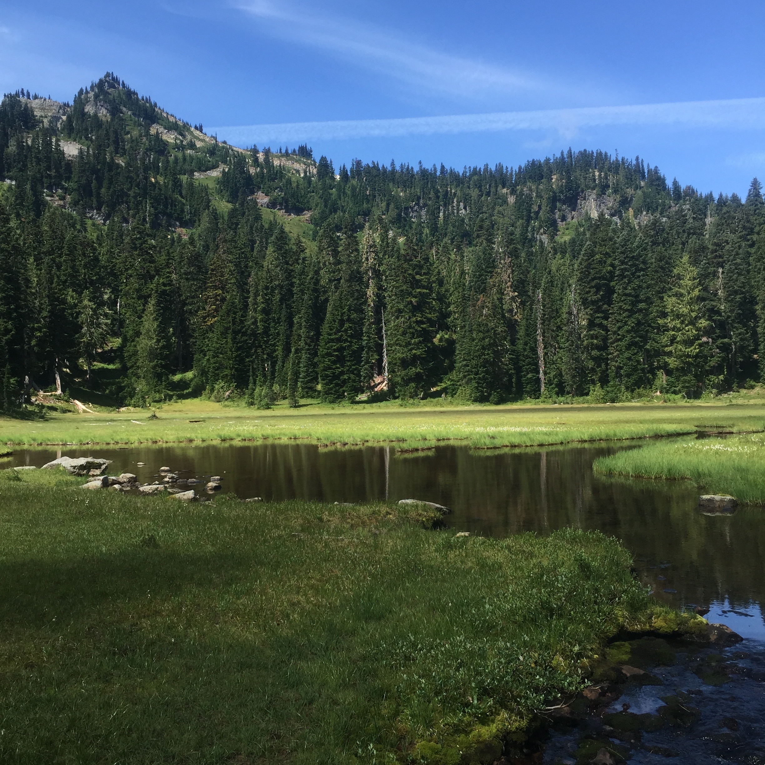
Meadow pond
After Dewey we started climbing again and passed a fire nice meadow pond then finally reached Anderson Lake where we stopped to have some lunch. I had my usual sardines, an Epic bar and some chocolate while Catherine loaded up on Epic bites and trail mix. We met a woman on horseback at Anderson and she told us to visit American Lake where we might see some mountain goats but we figured that would wait for another trip, we still had a long ways to travel today and didn’t want an extra side excursion.
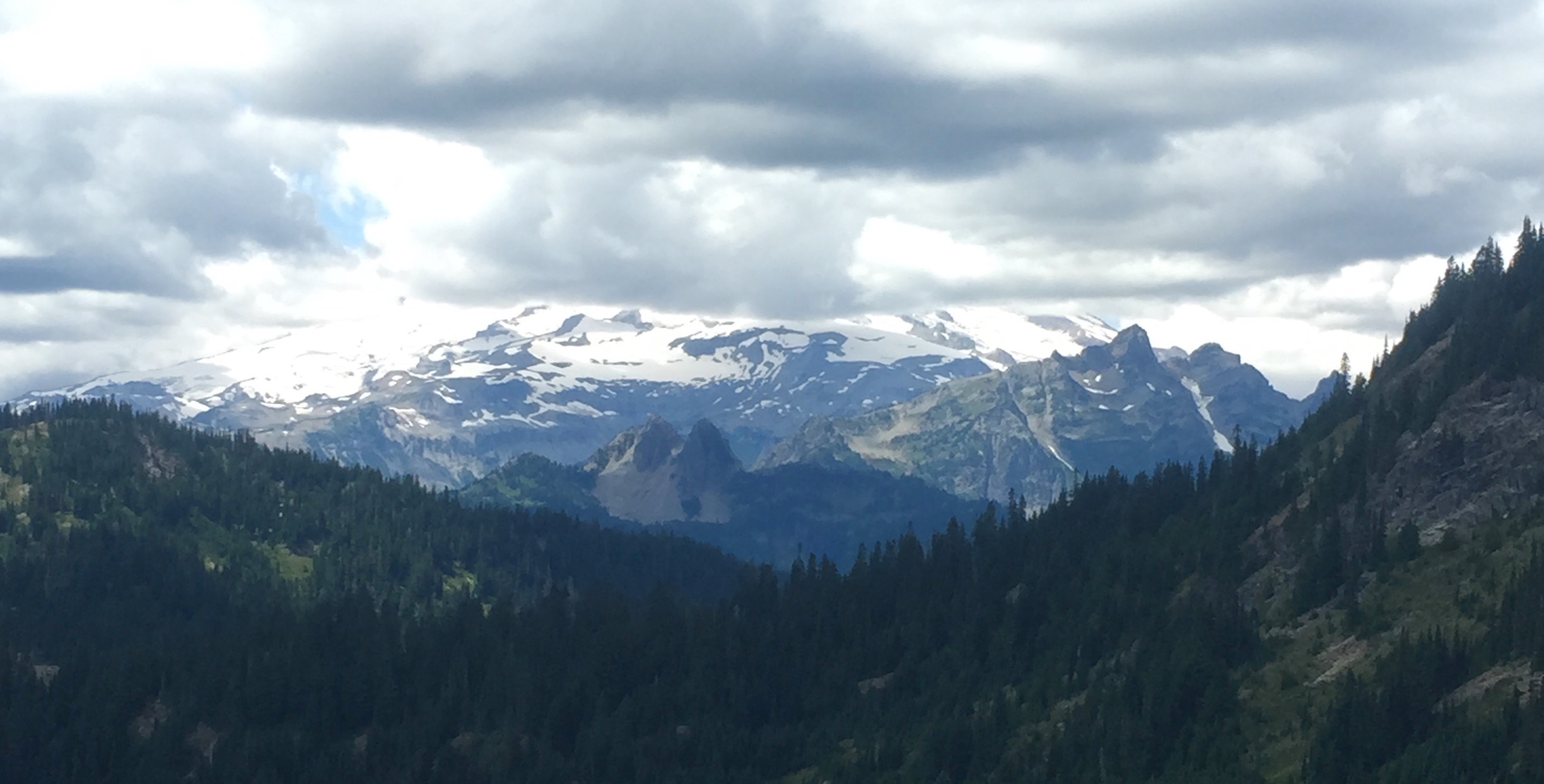
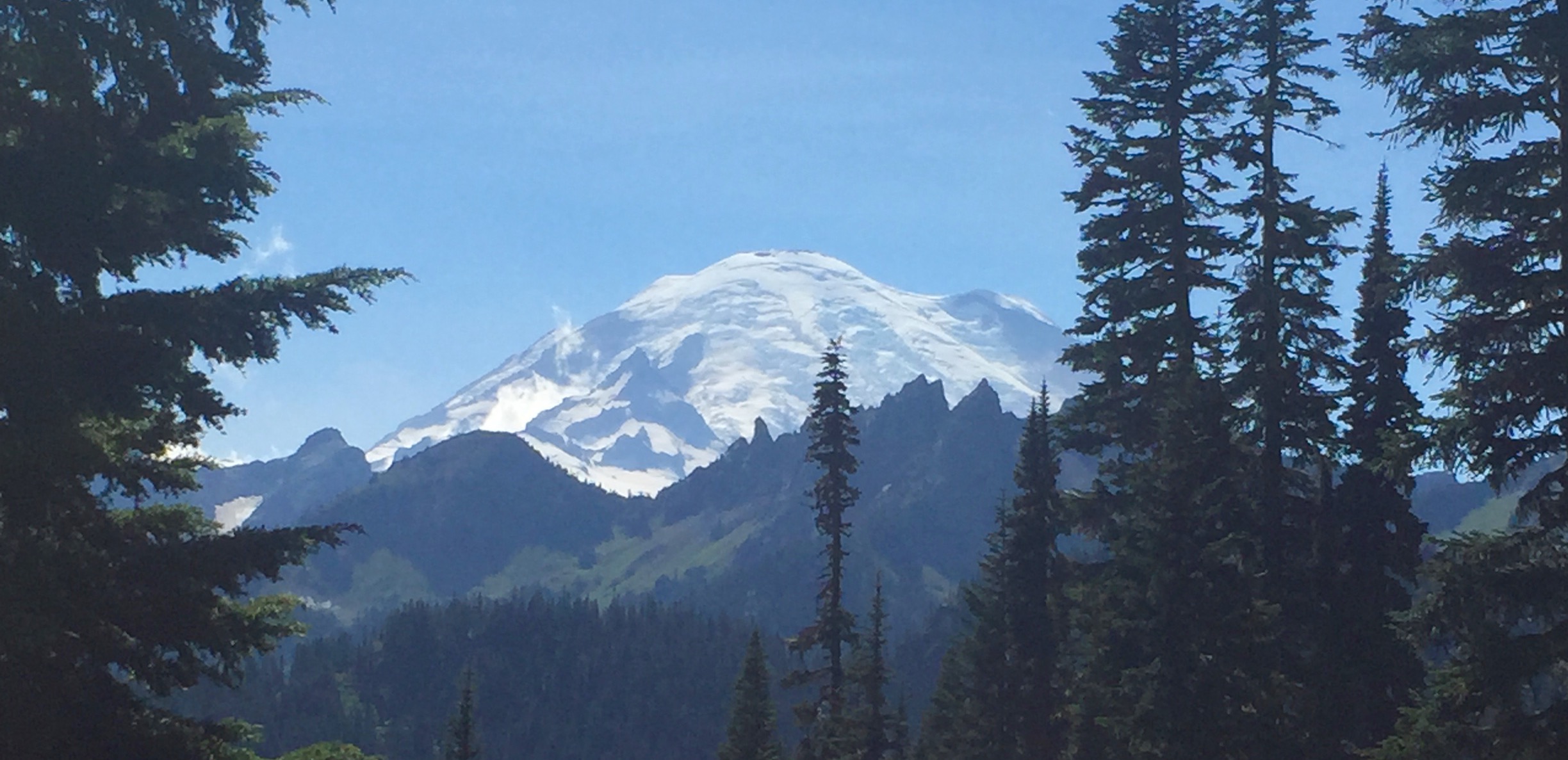
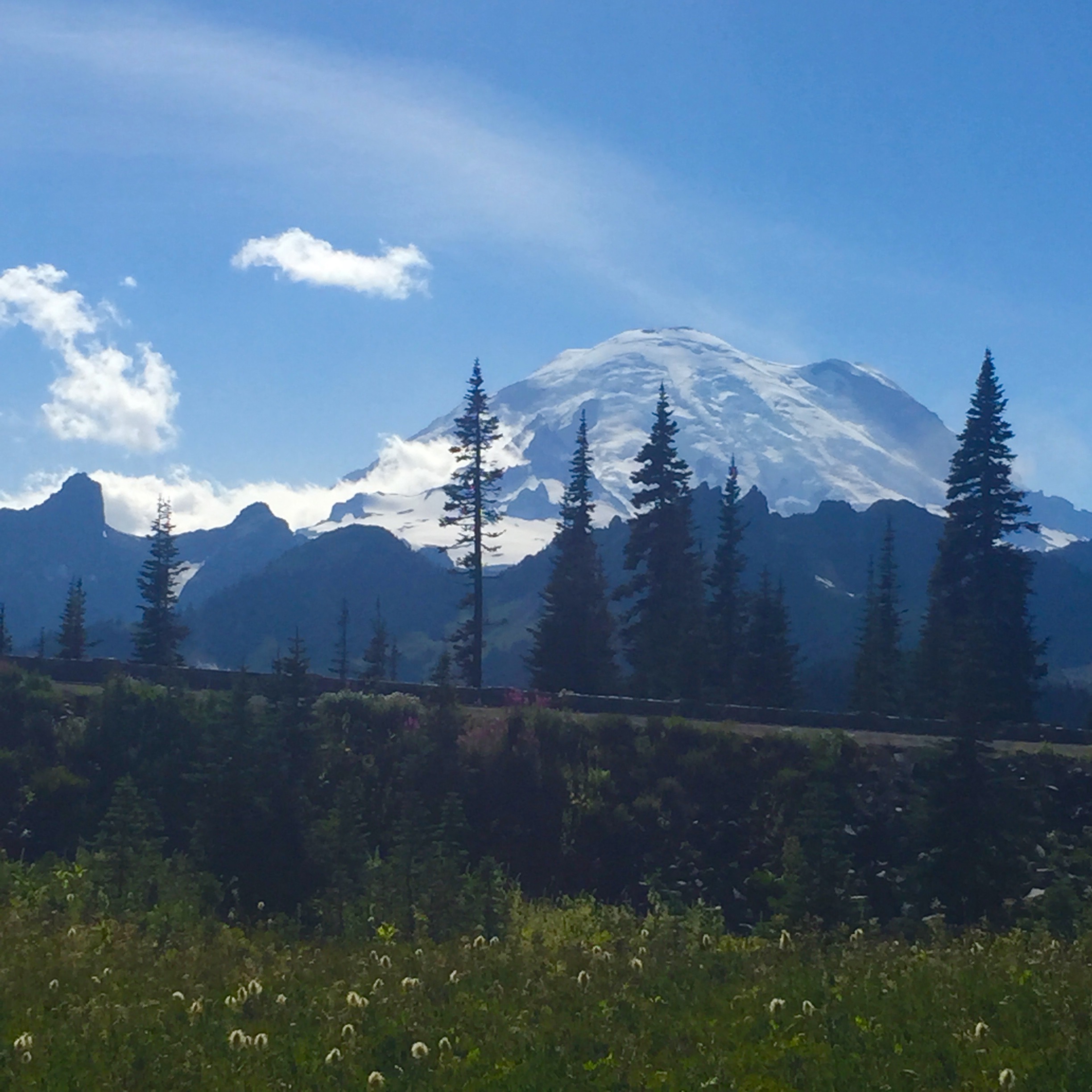
We climbed up again to the high ridge and finally had some views of the mountain which were a bit obscured by clouds. The mountain was definitely making its own weather today, it was blue sky to the east but a huge bank of clouds hanging right over Rainier.
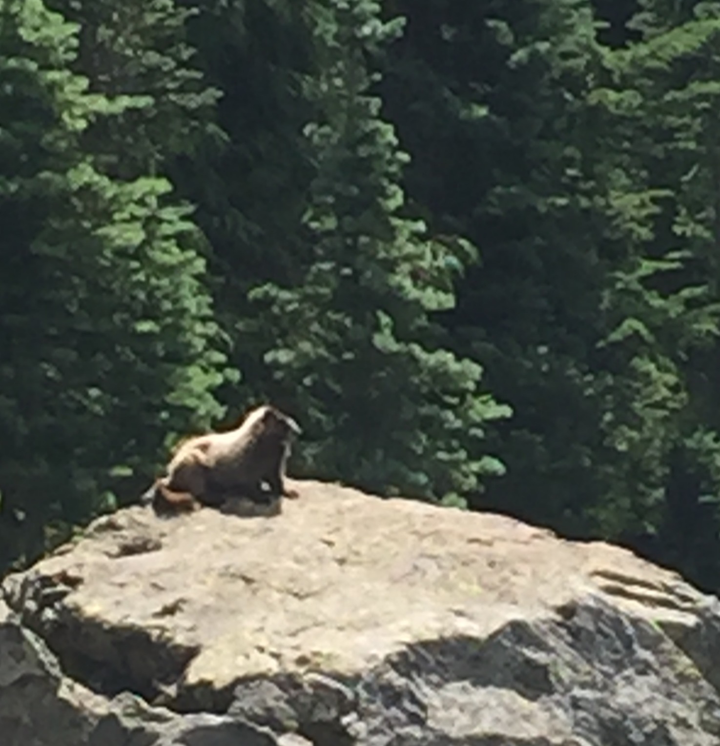
“Nice marmot”
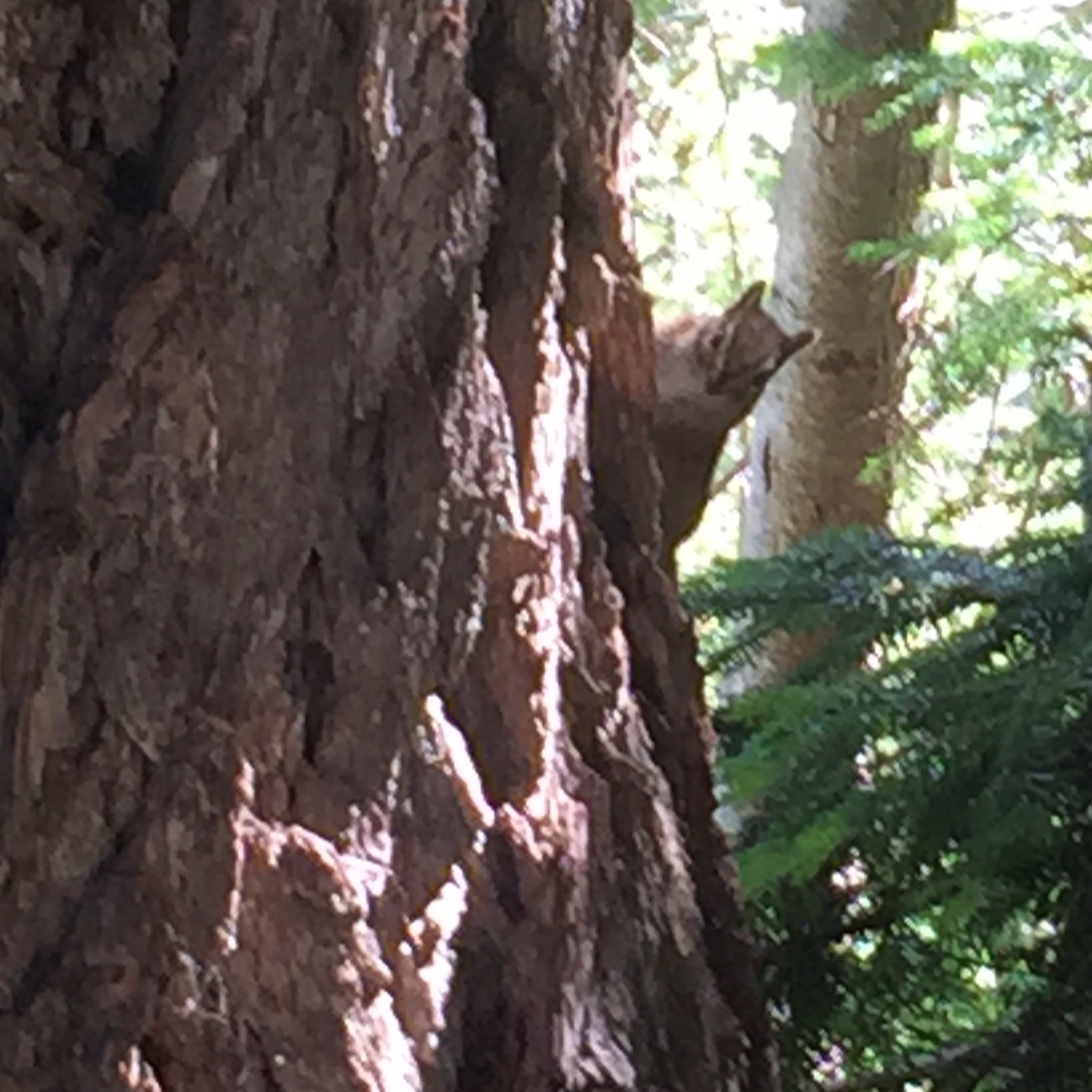
Coming up on a rocky stretch of trail I thought I saw something on one of the rocks, I wasn’t sure if it was the rock or a creature. I took off my sunglasses and figured it was an animal. I got a bit closer still not sure what it was but it turned out to be our one and only marmot of the trip. He finally startled and scurried off the rock as we approached. Can you tell I’m going for extra wildlife points on the Challenge? Unfortunately we saw no big wildlife but lots of signs of big wildlife – many elk tracks on the PCT and much bear shit on the Eastside Trail upper reaches. Other than that it was chipmunks, squirrels, marmots, ducks, frogs, slugs, many birds, mules and quite a few trout – more on all that later.
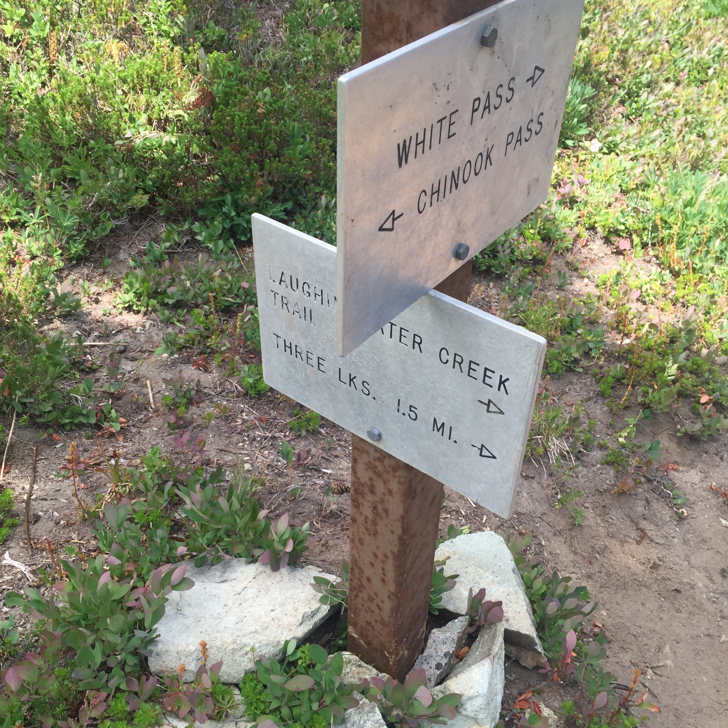 After many ups and downs along the PCT at about 11 miles in we came to the Laughingwater Creek trail junction and began a 1.5 mile descent to Three Lakes Camp. We passed the first small lake then another and finally got to the camp. I didn’t realize that this camp was in the Park and not the Wilderness Area, we’d been going in and out of boundaries the whole time. Of course we had no wilderness permit to camp there but I talked to the NPS people working on the cabin there and they checked with the Wilderness Center to make sure no one was coming up to camp and told us to take a spot.
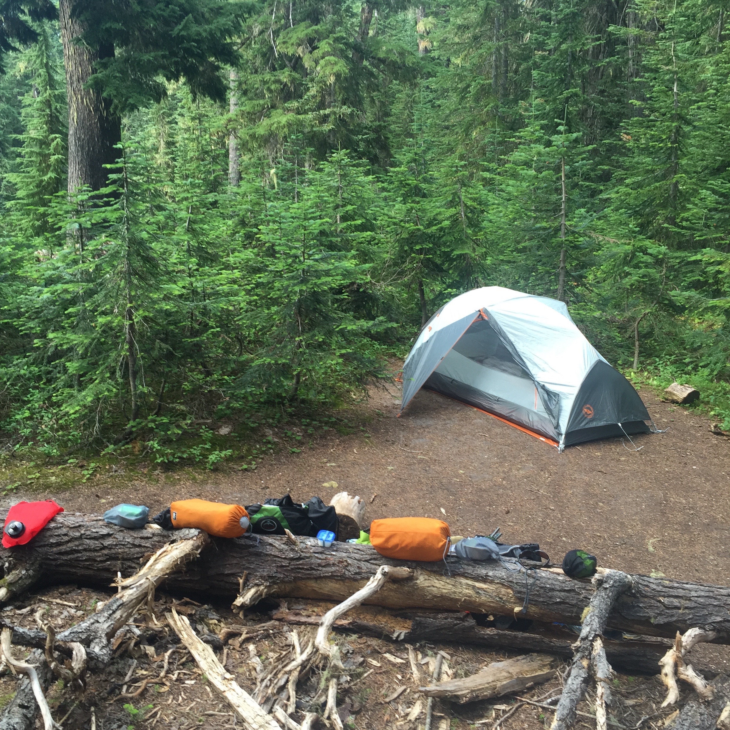
Three Lakes Camp
We got camp set up and I went to pump water and get food going. The guys told me where the spring was so I filtered water from it. This is when the fun started. We were cooking dinner when all of a sudden the mules and horses that the NPS guys had stampeded down the trail by our camp, I was sure glad we weren’t on the trail at the time, they were moving. The guys took off after them to try and find them.
Dinner by the lake
As we were eating dinner down by the lake we heard them coming back, one guy was riding one mule and leading the others who had bolted. A bit later they bolted again and we could hear one mule up at the cabin and several more back in the woods. The guys took off again to find them and evidently they set up a portable hot wire to pen them in off in the woods. After dinner we hung out a bit by the lake but then the bugs started so we crawled into the tent early. We both slept well and when I got up in the middle of the night to pee I was amazed at the stars out there, it was the clearest skies I’d seen in a long time and the sky was simply full of stars. We also got awakened by owls sometime around 1 a.m., there were at least two hooting like crazy.
Day 2 – Laughingwater to Ohanapecosh (10 miles or so)
Tenkara on the Ohanapecosh
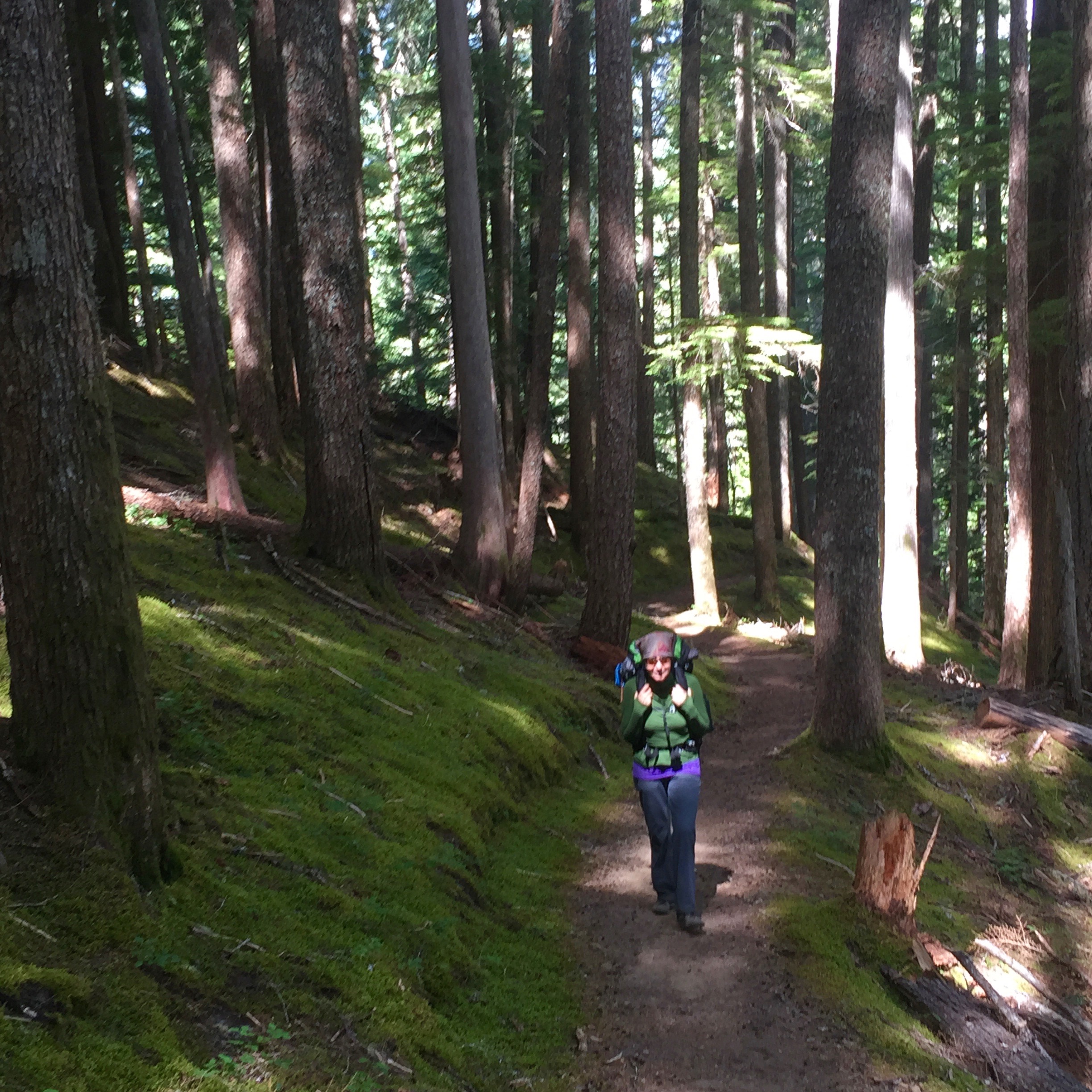
Early morning on the Laughingwater Creek Trail
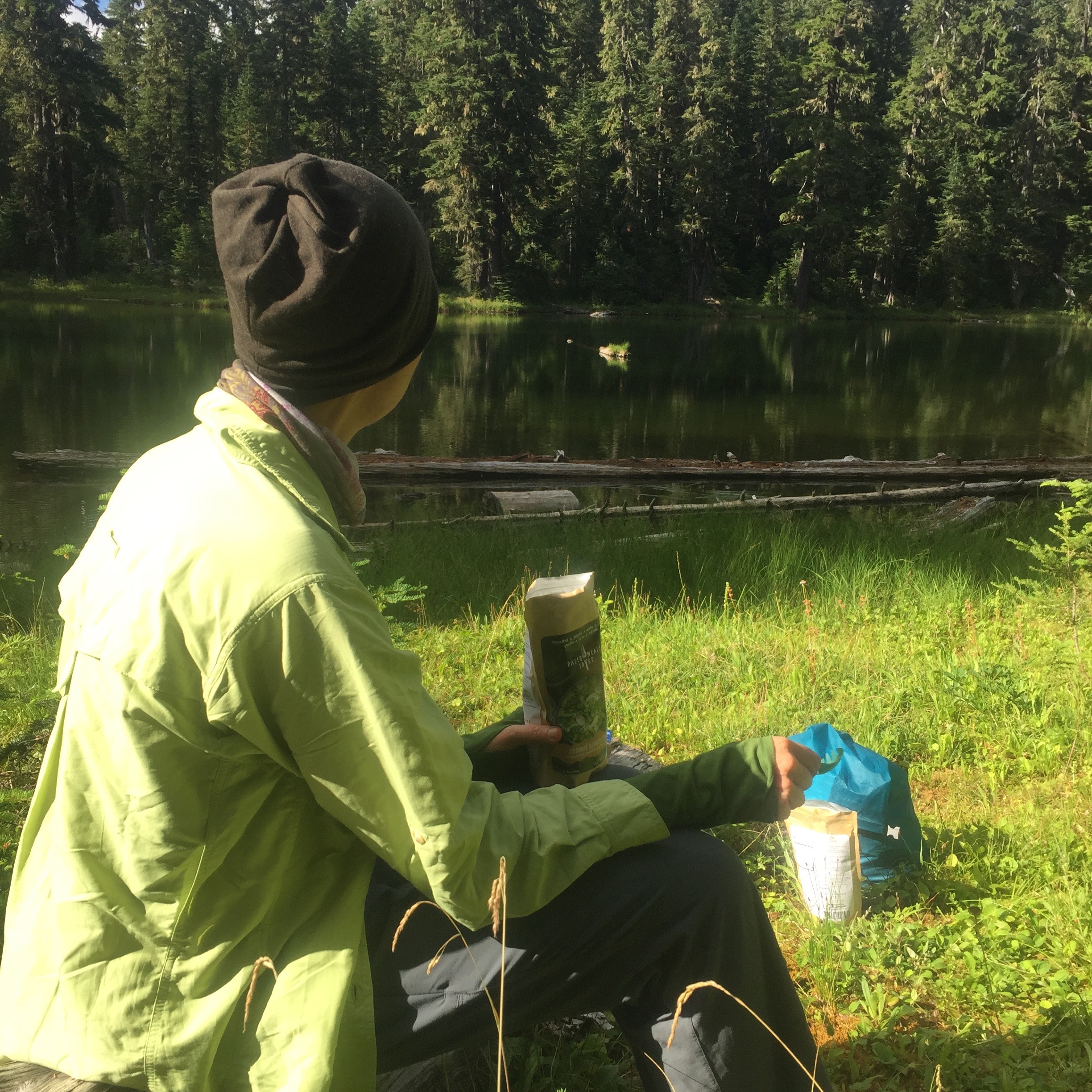
We woke early to begin our long downhill day to the Ohanapecosh River. I had a brainstorm in the middle of the night to try and give up our camp spot at the Ohanapecosh Campground and see if we could get a permit to camp at the Deer Creek camp so we decided to hit the park entrance to see if that was at all possible when we got down. We had breakfast of muffins, Epic Bacon Bars and tea then broke down our somewhat damp camp and headed down the trail starting at about 8 a.m. We talked to the guys at the cabin a bit so really didn’t get moving until around 8:30.
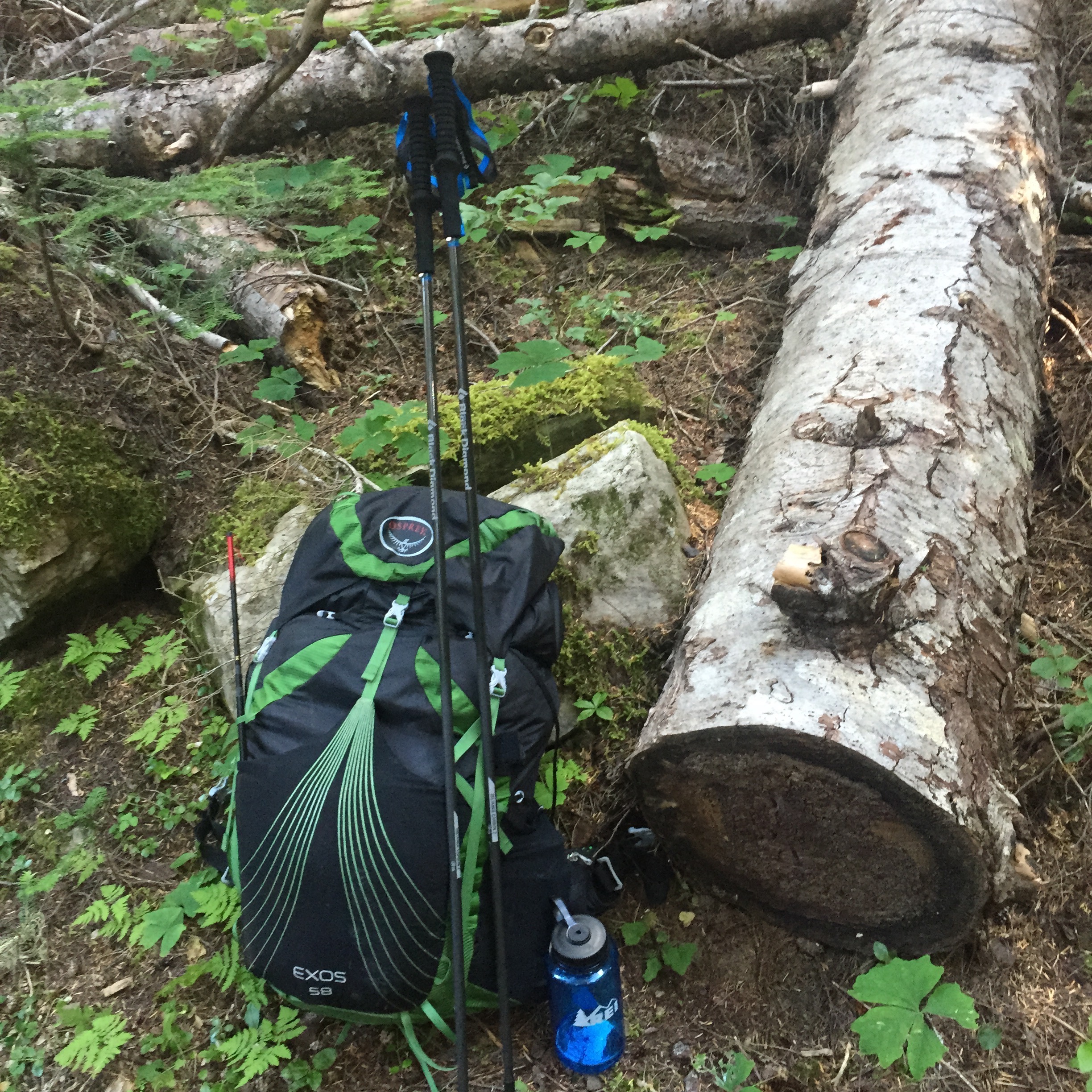
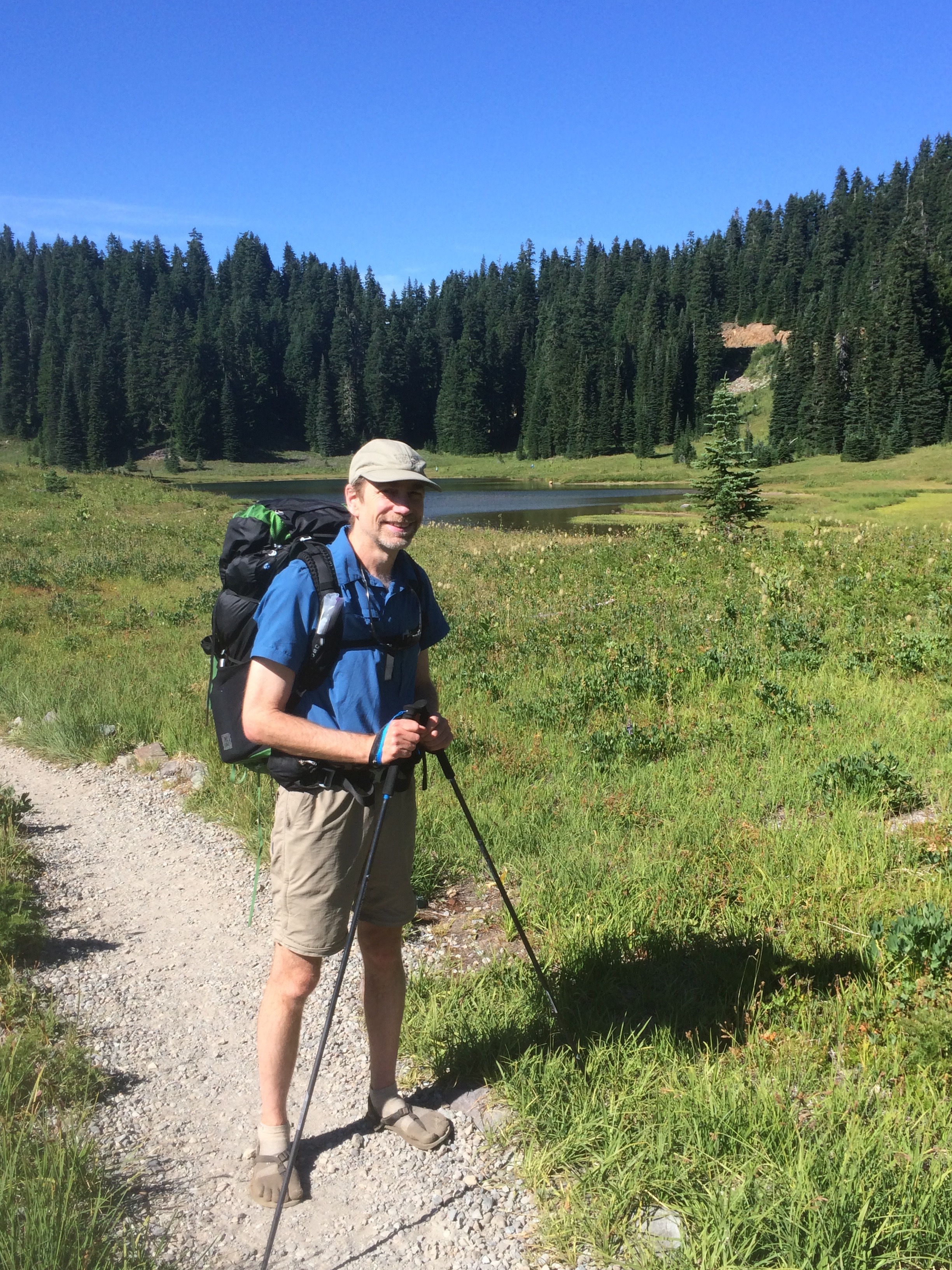
New trekking poles to try
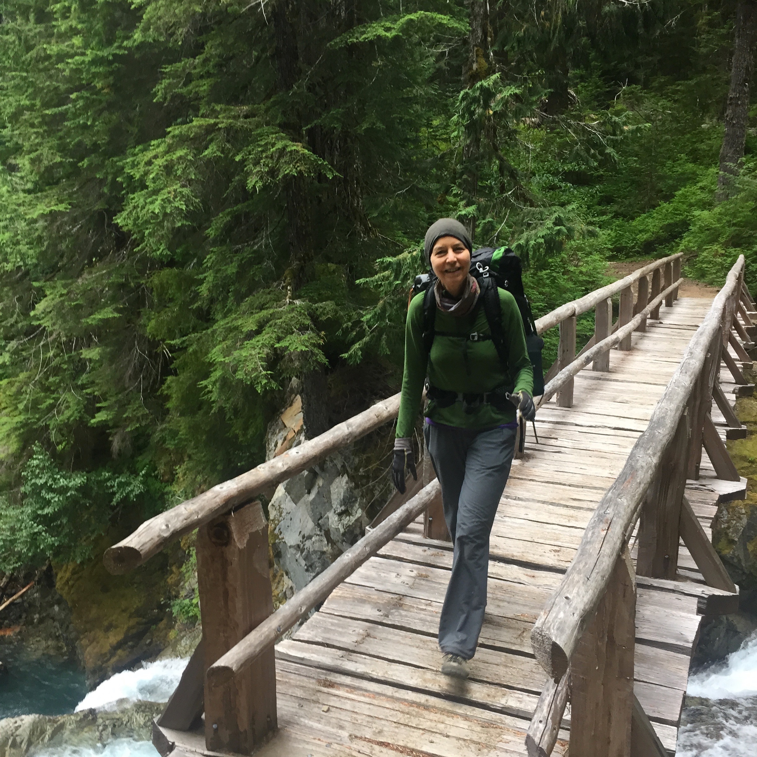
This trail was a really nice, soft downhill the whole way through a pretty amazing forest. There were a few big old growth trees around and in places the entire ground was covered in moss, making a magical forest. The first few creek crossings we hit were totally dry and I was thinking there wasn’t much laughing water but after a bit we did run into the creek proper which kept us company for much of the descent. I tried out my new added equipment on this descent – a pair of Black Diamond Distance Z Carbon trekking poles. These things weight nothing, fold up small and were great for the descent (and later for the tough ascent on the Eastside Trail.)
Moss land
When we got down to the road we crossed and headed north to check with the Steven’s Canyon entrance about our plan B idea. It wasn’t even noon yet so we figured another 7.1 miles was do-able if we could get it OK’ed. The poor kid at the entrance had no idea what to do so I told him to call the WIC and see if we could pull off a permit. No one answered the phone so I told him we’d go eat lunch and come back.
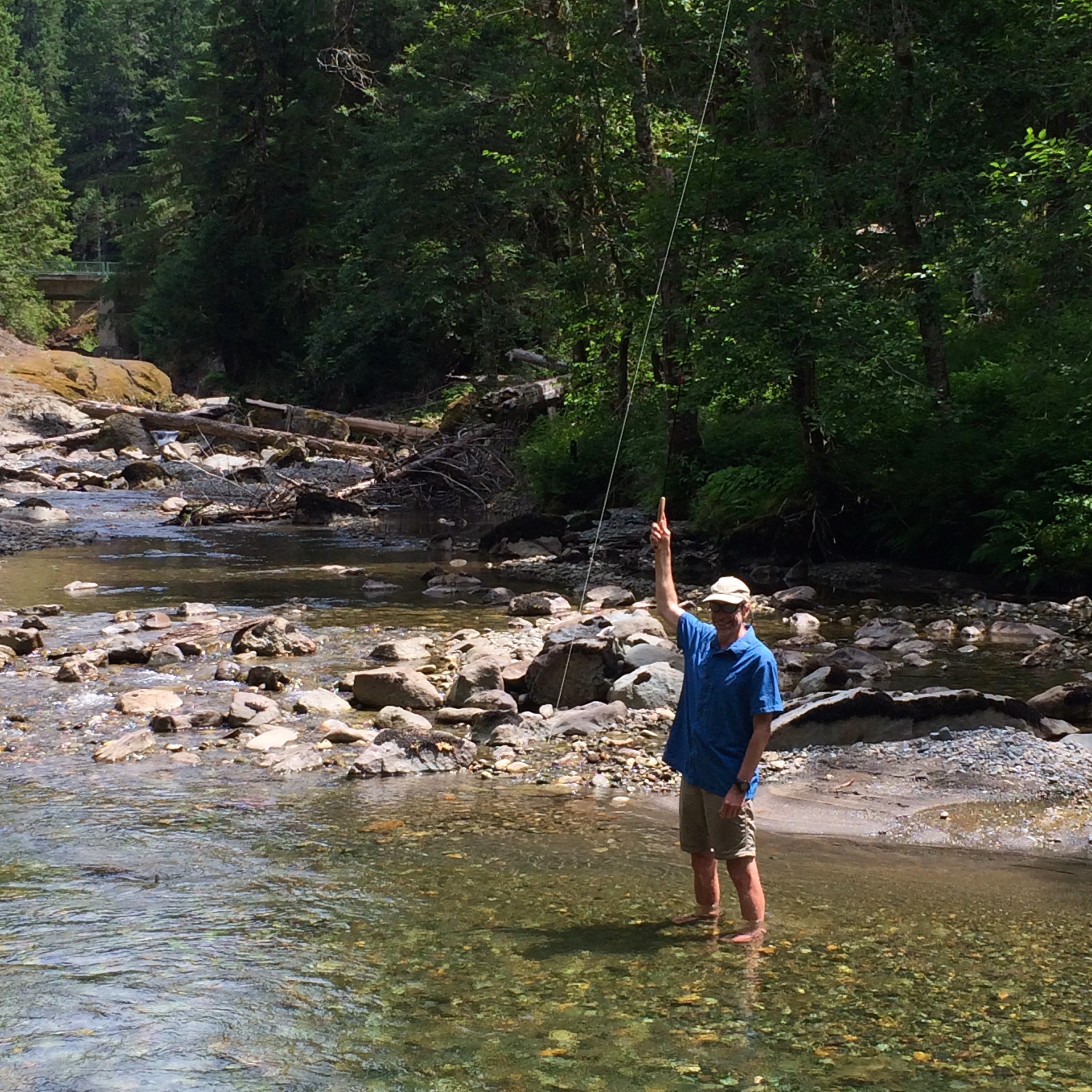
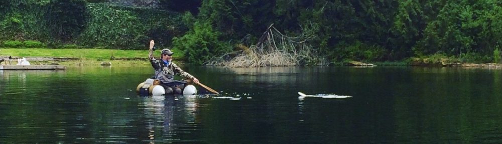
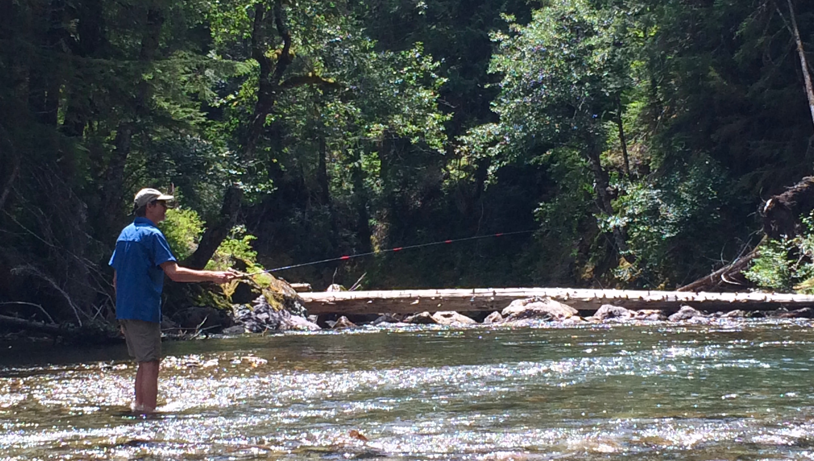
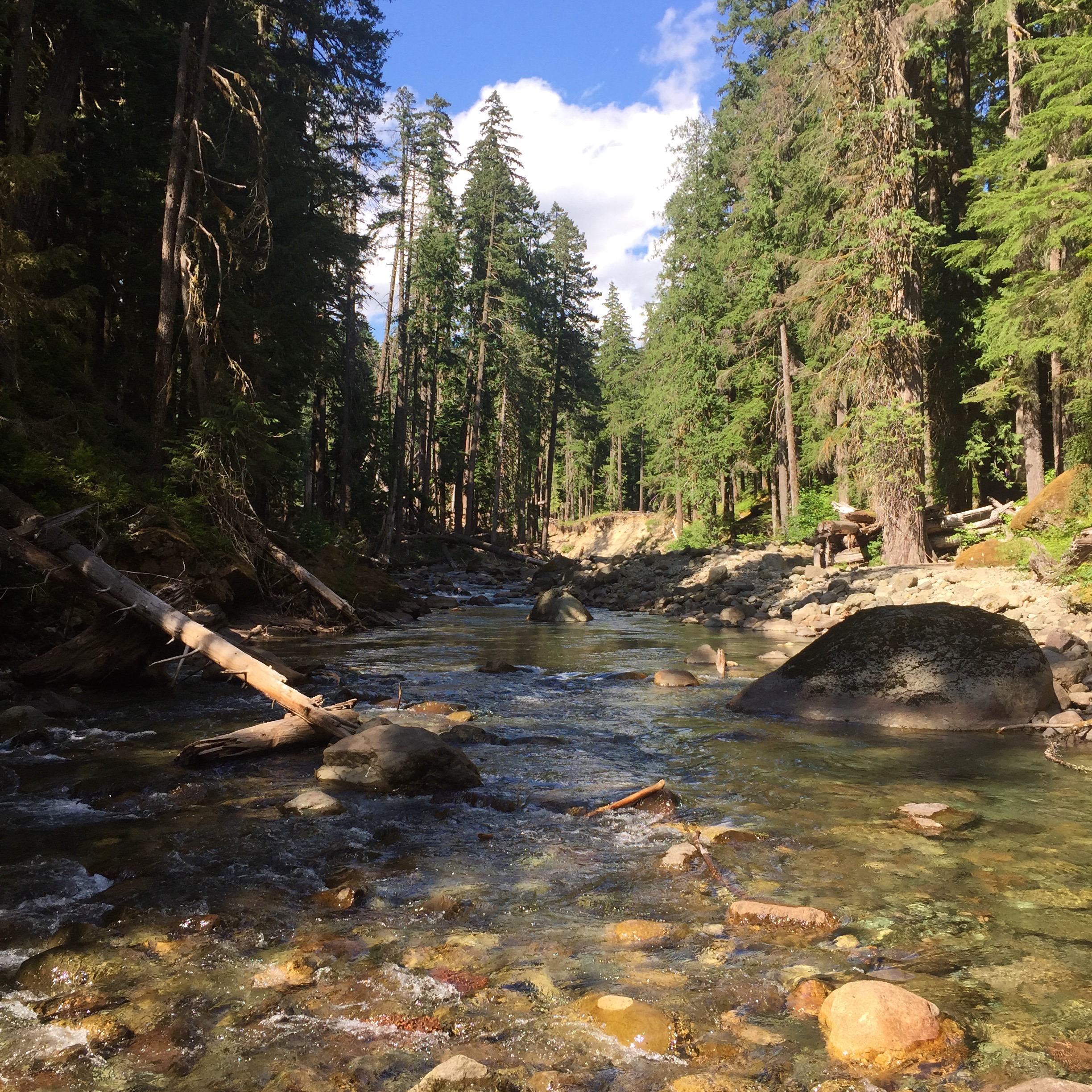
Fish on!
We headed down to the river for lunch and found a great spot on a gravel bar. After a quick lunch I couldn’t resist and had to pull out the Rhodo tenkara rod and fish. These fish have never seen a fly it seems, I was getting a fish every cast. Brook trout, rainbows and cutthroat all out of the same small run. This was really fun and it was also good to wash the grime off my feet finally and cool off in the river. After I fished the two small pools there we headed back up the hill to the entrance and found that they could not issue a permit there, we’d have to go to Paradise or Sunrise to get one which was out of the question so down to Ohanapecosh we went. All this added about 4-5 miles to the length of the trip since we covered some of these sections of the Eastside trail and the campground trail twice.
At Silver Falls
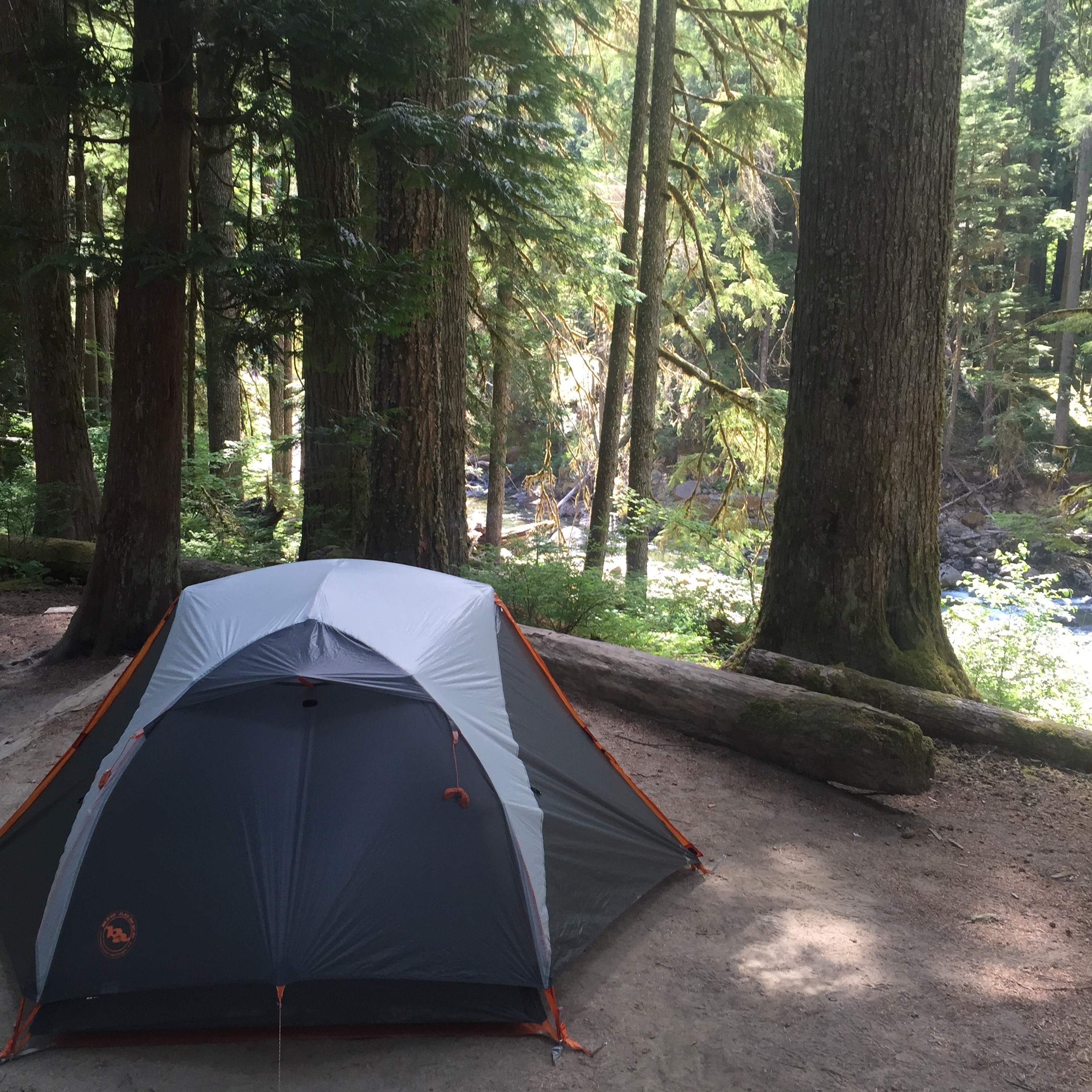
Riverside camp at Ohanapecosh
Surprisingly the campground was pretty nice and even though there were people it was quiet. We had a site right on the river surrounded by tent-only sites so there was no big RV next door. We had running water so no need to pump and a bathroom not too far away. We had some time to kill so I, of course, hit the river again getting quite a few nice cutthroat in the pool just down from camp. Catherine found a flat spot and did some yoga by the river.
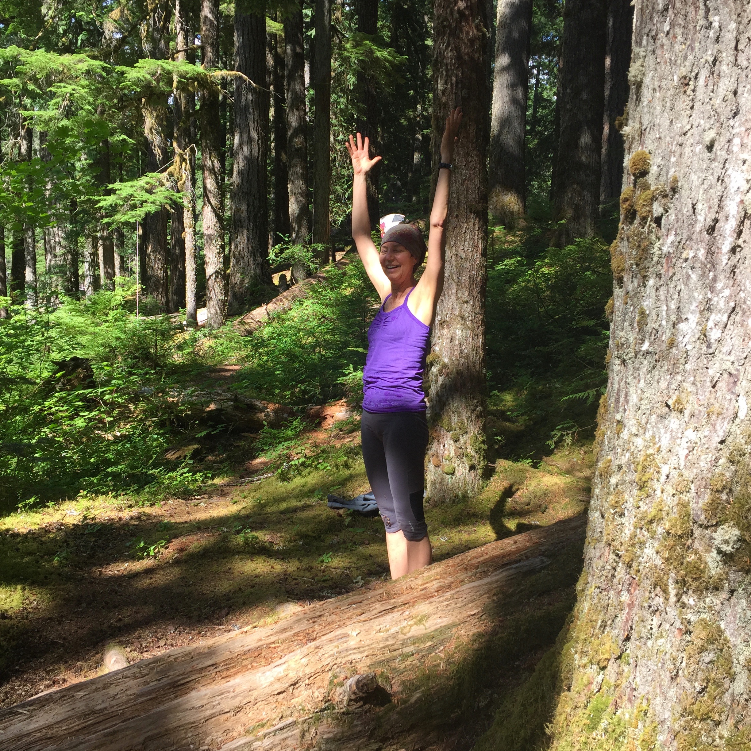
Yoga by the river
My best fishing spot
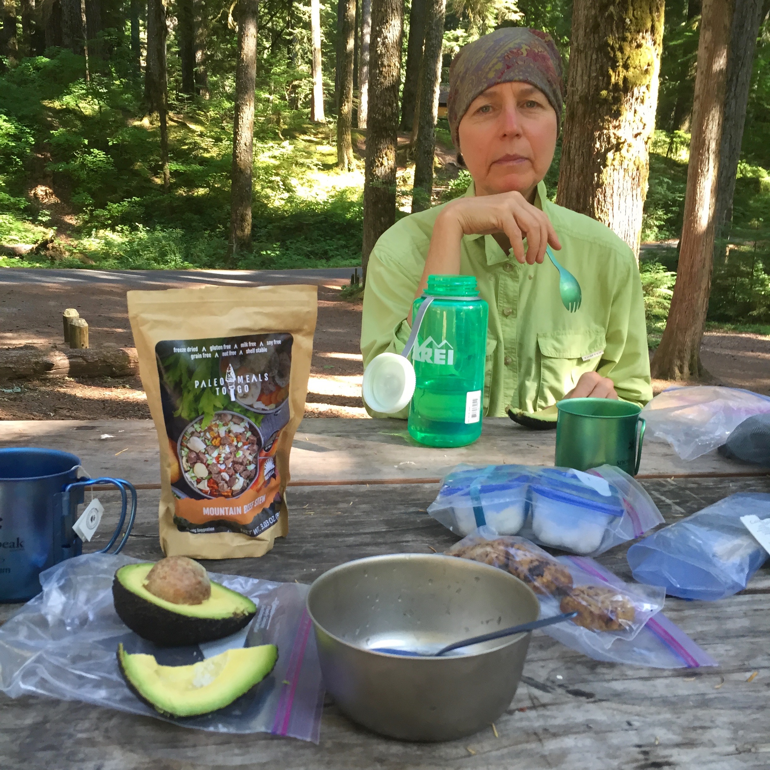 We finally stopped to make dinner – Paleo Meals to Go Beef Stew with some extra coconut oil, avocado, cookies and tea. It felt kind of strange sitting at a picnic table instead of a log while eating dinner. After dinner we went back down to the river for a while. I did a bit more fishing at dusk and then we just hung out on the bank for a while watching the sun go down all the way. Finally we went back up and got settled in the tent for the evening and slept well but thinking about the tough day ahead.
Day 3 – Ohanapecosh to Chinook Pass (13.7 miles)
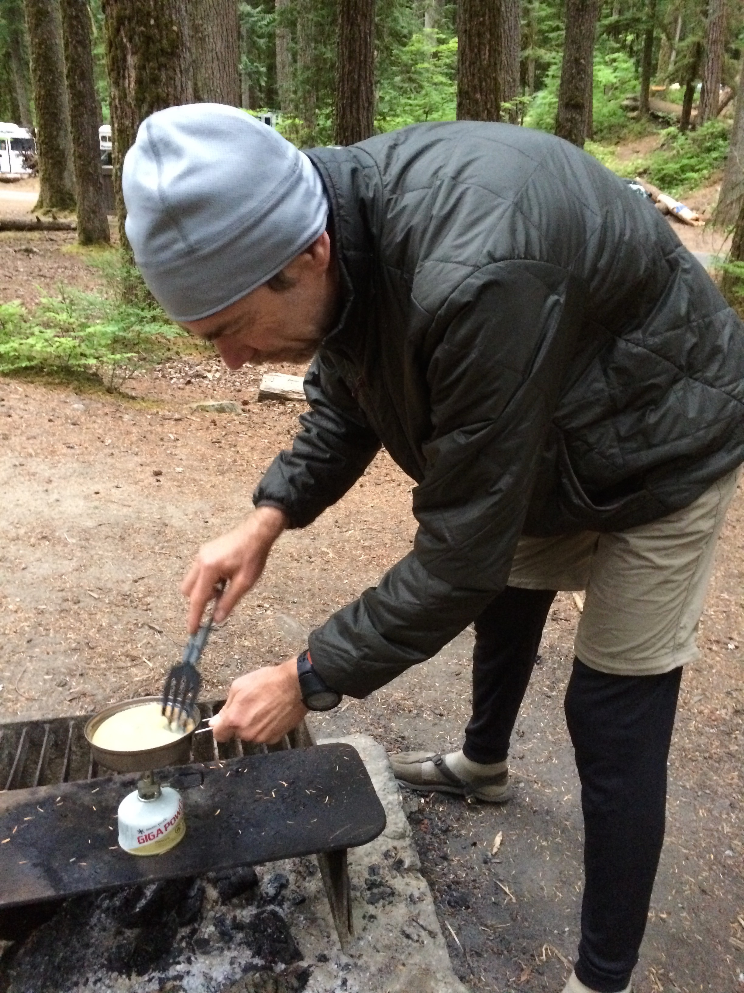 We woke up early, probably the first people up in the campground, and got on task to make breakfast and get ready for the long day ahead. This was to be our longest and steepest day of hiking yet for the year. To get ready we really fueled up well. I made eggs (from egg crystals) on the stove which was challenging but at least the stove was stable on the fireplace grill. We had those along with muffins, more avocado, Epic Bacon Bars, dried bananas and tea. I tossed some extra coconut oil on my food too. We then packed up camp and set off on the trail, heading to the Grove of the Patriarchs 2.5 miles in for our first break of the day.
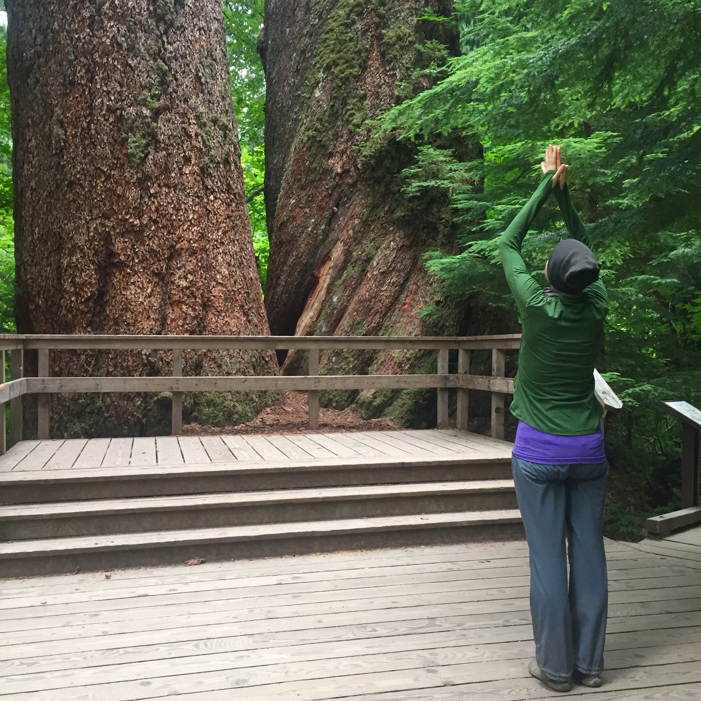
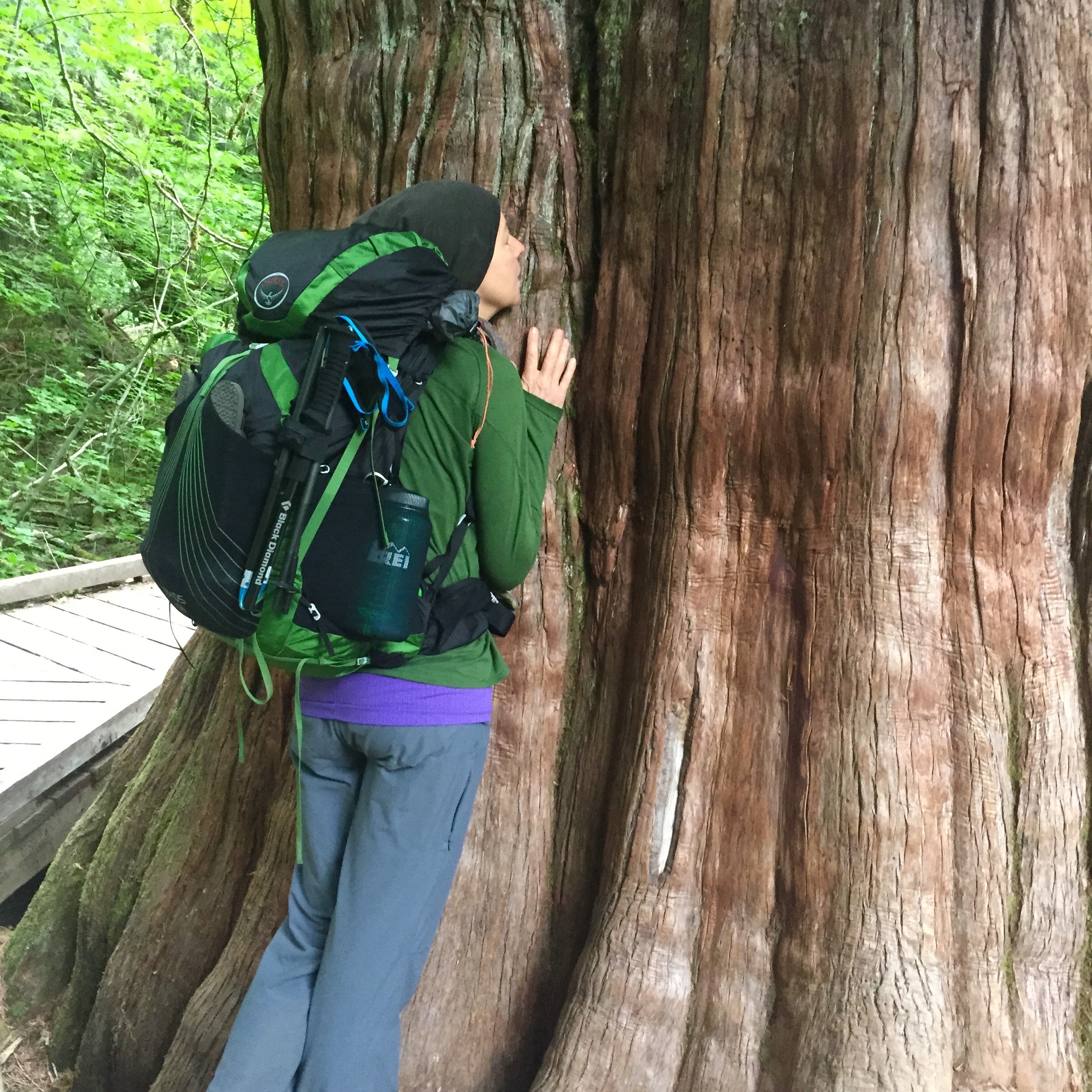
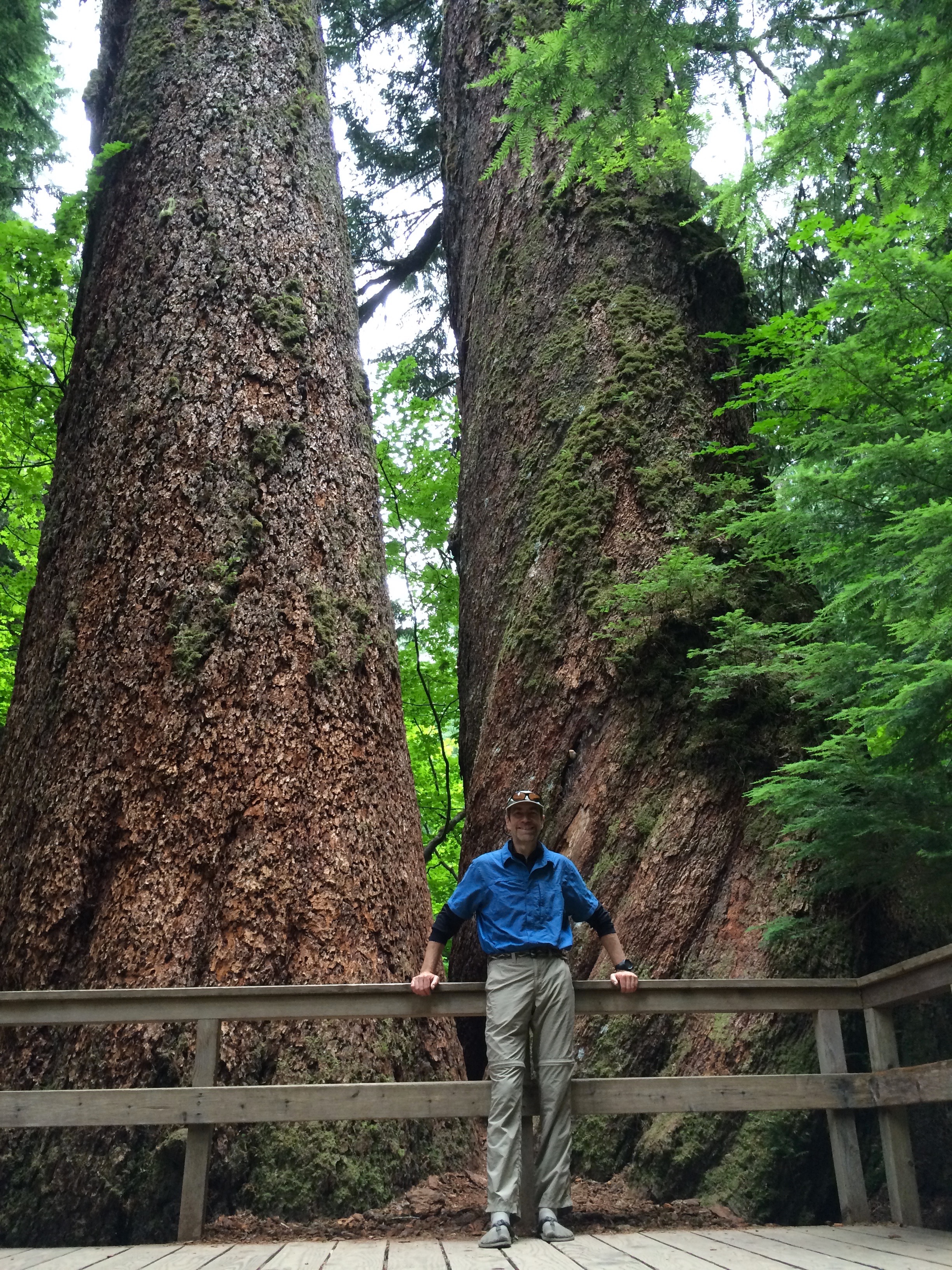 We spent some time at the Grove, it was like a cathedral in there and we had it to ourselves for the first 20 minutes or so. We had a snack, looked at all the trees and finally did a series of bows at the Twin Douglas Fir trees and gave the big cedar a hug. Little did we know that this was the start of the old growth for the day, the Eastside Trail was filled with old growth trees that we got to experience the whole rest of the day, that was a pleasant surprise for sure. Still, nothing quite beat the really big old trees at the Grove. It was worth spending a lot of time in there and adding in an extra .5 miles to the total trip.
Last of the Ohanapecosh
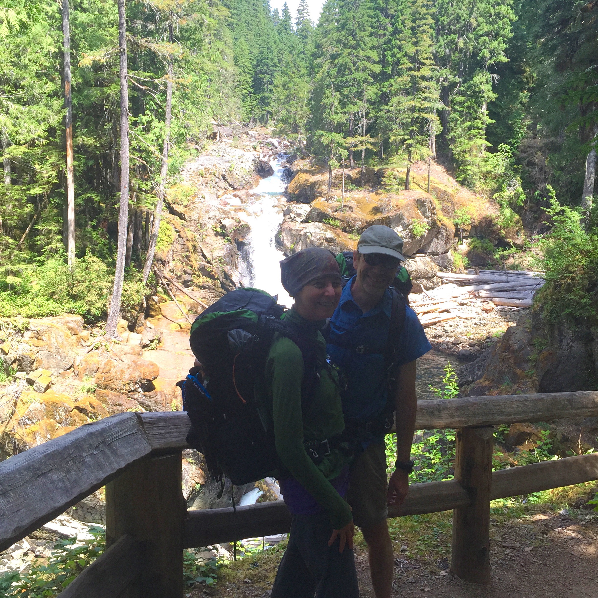
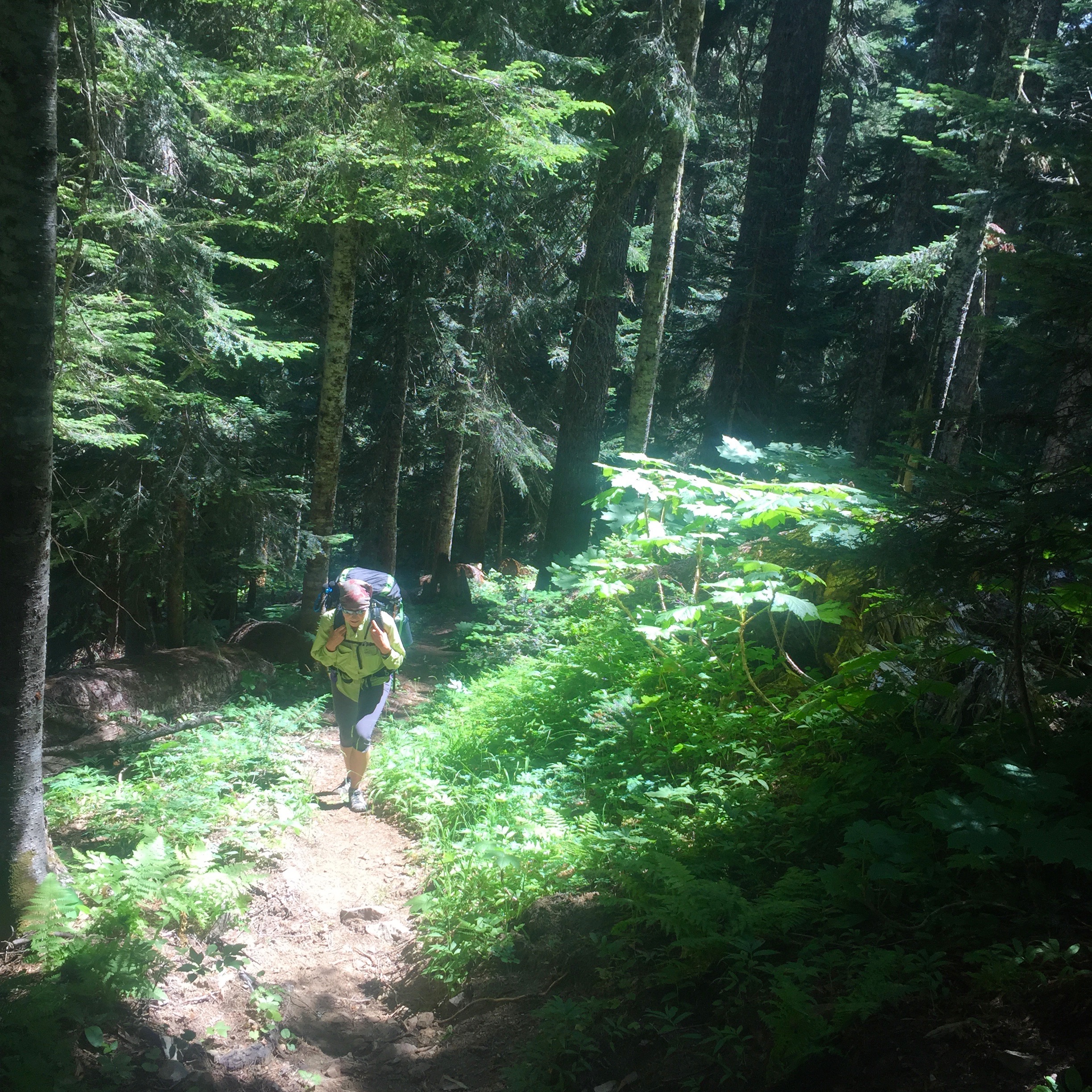
North of the Grove the Eastside Trail gets thin and way less travelled. I figured we wouldn’t see anyone again the rest of the day and that pretty much held except for a few people at Deer Creek Camp who had walked in from the road. We followed the Ohanapecosh a long way and boy did I want to go down and fish several pieces of water but couldn’t since we had so much ground to cover. Finally after many miles we crossed the falls that took us over the Ohanapecosh and starting up the Chinook Creek valley instead.
Chinook Creek at Deer Creek Camp
Chinook Creek was also beautiful and the valley was still full of old growth trees. We hiked on up to Deer Creek Camp where we stopped for lunch and our final fuel before the really hard climb started for the last 3 (or 4 depending on which sign you believe) miles. After a lunch of sardines, muffins and chocolate I couldn’t resist the creek so pulled out my tenkara rod and proceeded to catch some small cutthroat from Chinook Creek. This would be a very nice backcountry campsite if it wasn’t for the fact it is .2 miles from the highway so I’m sure you’d hear cars all night long.
A steep stretch
Now the real fun began. I got my poles out and we started the climb to Cayuse Pass. Pictures can’t do the steepness of some places justice. It was really steep. Why do switchbacks when you can just go straight up a hill? The poles helped a lot, I could kind of pull myself up a bit using them.
 After what seemed like forever and a lot of breaks every 45 minutes we came to Hwy 123 and the final stretch of the trail up to Cayuse Pass. It was good to see the road but looking up you could see how high up the pass was still and we had that much elevation still to gain. We crossed the road and got back on the trail and began more climbing but a bit easier now, there were even some switchbacks instead of just straight up trail to deal with. We got up to the road and I was excited but then realized it was the lower part of the road and we still had to traverse and climb to the upper portion of the road.
Once we hit Cayuse Pass we knew we were effectively done. The views of Mount Rainier were spectacular at the Pass, the best views of the mountain we’d had on the entire trip.
At Tipsoo Lake
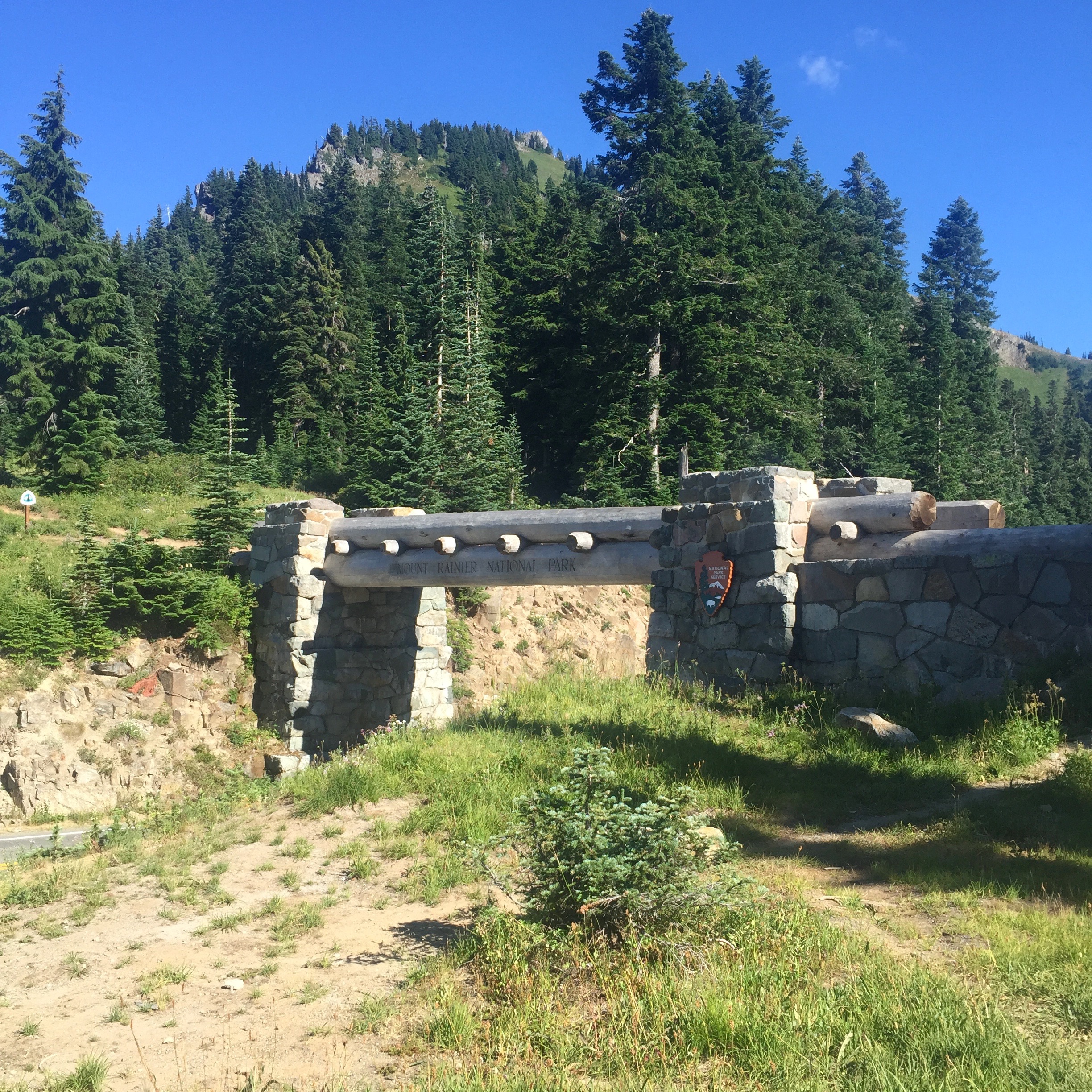
We headed down the trail to go around Tipsoo Lake to our final destination, Chinook Pass and the car. The last little stretch on the Naches Peak Loop went fast and as we came down to the bridge/PCT/National Park boundary we knew it was all done. Catherine did her happy dance and we headed to the car where we knew a cold komucha and some extra food awaited us.
Back where we started
We ended at 5 p.m. so the entire trip took us 56 hours from start to finish. Not bad for a couple of grannies on only their 3rd backpacking trip. We’ve got to thank Ras & Kathy Vaughan for this great route and putting up the Wilderness Challenge which motivated us to get out and do this beautiful loop. Also thanks to all the runners who blogged about the route and posted the elevation charts and GPS tracks, it let us know what we were getting into. Given that last year at this time I was pretty much unable to do much of anything and wasn’t even sure I’d make it through the year alive this was indeed a challenge for me and I went in not 100% sure I’d be able to do that many miles in 3 days. This loop makes me want to do all the UPWC routes past and present and it also got me thinking about the Wonderland Trail for 2016, I’m going to start my research now.
Notes on Gear & Food
Footwear
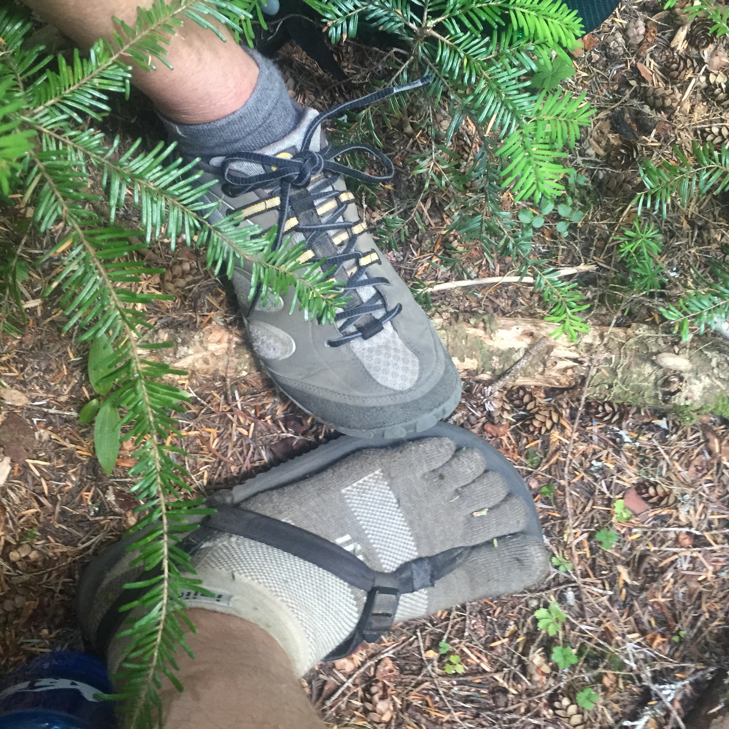 When we got into minimalist running a few years ago it changed our whole attitude about footwear and we gave up on hiking boots which weigh about half as much as our gear. I hiked in Altra Superior 2.0 shoes and Luna Leadville Sandals. The Leadvilles also double as a great wading shoe. Catherine hiked in her Merrill Trail Gloves the whole way but used her Luna Osos at camp. Both of us wear Injini socks when wearing socks.
Food
Food-wise we stuck with Paleo Meals To Go for dinner but I also added some Ova egg crystals which aren’t pastured eggs but were darn good eggs, some dried whole bananas I found at Whole Foods and some coconut butter which I just ate by the spoonful at snacks. Lots of Epic Bars and Bites and some Tanka Bites too. I’m still figuring out this whole Paleo/AIP food thing while hiking and next time hope to dehydrate some of my own food thanks to Backcountry Paleo and Paleo Traileo.
GPS Data
Here are the Movescount pages for each of the days. I’m not sure why my Ambit freaked out on Day 2 which is why I’m uncertain of the mileage for that day. My watch was on its last leg by the time we got to the car, I need to carry a charger cable next trip.
- Day 1 – Chinook Pass to Three Lakes Camp
- Day 2 – Laughingwater to Ohanapecosh
- Day 3 – Ohanapecosh to Chinook Pass
The Strava data after being imported from Movescount is a bit wonky but here it is if anyone wants to see it. You can better see our ups and downs to the entrance on Day 2 better on the Strava map than the Movescount map.